His return address was his last name and nine-digit Zip code.
Tag: Maine
How you locate where the international border runs between two islands
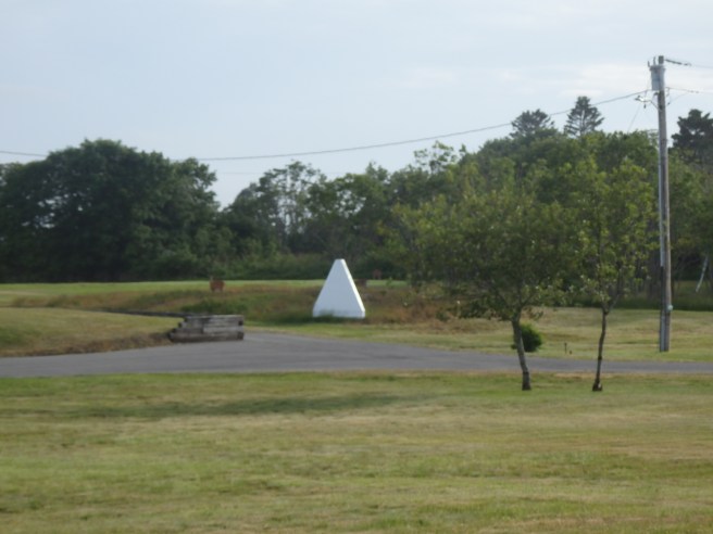
Pyramids like this sit in prominent spots along the shore. They can seem mystifying enough, even before you see a second one nearby.
At last, I learned the two can be lined up to create an imaginary line running out across the water. The border between the United States and Canada falls where the line crosses a similar line running from islands on the other side. That spot can then be connected to others, at least by some kind of maritime surveyors. It’s another example of connect-the-dots.
The four-sided pyramids are called range markers. They’re a special kind of daymark or day beacon, too.
BAR cars stuck in the woods
Seeing railroad boxcars away from the tracks around here no longer surprises me. Many of them stand beside farmhouses and sheds or even businesses, where they serve as extra storage space, presumably cheap or for the taking.
But this sight along State Route 191 always grabs me.
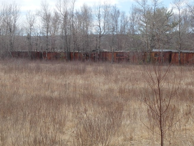
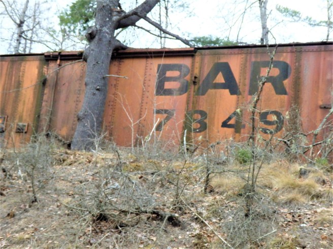
The Bangor and Aroostook Railroad served Washington County as well as the Penobscot Bay region and the spud country up north.
When sardines were big
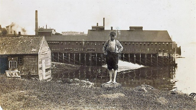
Eastport’s economic glory days were when the city was the Sardine Capital of the World.
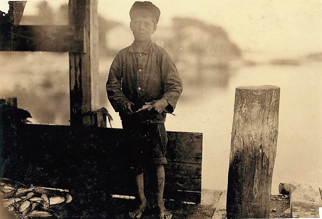
They’re small herring and abounded in the waters around Eastport, where they were easily caught and delivered straight to the cannery atop the wharf.
Here are some related facts.
- Napoleon Bonaparte helped initiate the canning of sardines, the first fish to be so preserved.
- Packing in Maine took off from Eastport in the 1870s and peaked around 1900, with 75 plants, mostly along the Downeast coast. The first sardine cannery in Eastport started in 1865 but failed to reduce the moisture in the cans, leading to a sharp, unpleasant odor. Its owner returned to Portland and found success with baked beans. Others in Eastport improved the process.
- The workforce was largely women, with blurring hands and sharp knives or scissors expertly packing the small fish into cans – as crowded as sardines, as the popular expression went. Their hands were in cold seawater, year-‘round.
- Eastport also cranked out the cans and lithographed labels.
- The fish were packed in cottonseed oil, soy oil, or upper-end mustard sauce.
- The world’s biggest sardine cannery jutted 250 feet out from the shore at the entrance to Shackford Cove.
- Home refrigeration doomed the industry, making fresh cod, haddock, and other fish readily accessible.
- Sardine tins were part of soldiers’ rations during the world wars.
- The discarded fish parts were used to make fertilizer, while the scales were transformed into pearl essence, a shiny coloring used in many consumer products.
- Vintage sardine cans and labels are collectors’ items.
The Bingham connection
After discussing Maine’s unincorporated townships, I need to add that there are a lot of variants – 17, if I’m counting right. Among them are the BKP, BPP, NBKP, NBPP, and WBKP designations – translated as Bingham’s Kennebec Purchase, Bingham’s Penobscot Purchase, North of Bingham’s Kennebec Purchase, North of Bingham’s Penobscot Purchase, and West of Bingham’s Kennebec Purchase.
So just who was this Bingham guy?
In short, he was William Bingham, already a wealthy Philadelphian when he became filthy rich via privateering during the Revolutionary War. He was also a statesman and U.S. senator who parlayed his riches into vast land purchases, as noted above but also including upstate New York, where Binghamton, where I’ve also lived, was named in his honor.
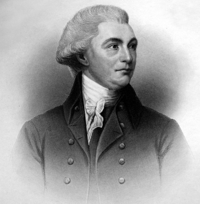
Quite simply, Bingham owned two million acres in Maine, making him land rich but cash poor.
His agent in Maine, Revolutionary War Gen. David Cobb, was responsible for laying out most of the roads associated with the Airline Highway (now eastern State Route 9). And when Cobb retired in 1820, John Black, agent for Baring Brothers Bank in London, felt that lumber was the wealth that would provide his boss the needed profit. There were further complications as well as marriages, but you get an idea how Baring township in the Moosehorn wildlife preservation got its name.
Cobb did, however, build a great house at Gouldsborough and soon faced some harsh realities that he notated between 1795 and 1800.
First, the land and climate of eastern Maine were not and are not suitable for farming. He noted that “those who come to view the country … have as frequently returned almost blind by the bites of flies and mosquitoes. You have no conception of the hosts of these devils that infest the thick forest at this season.”
More critically, he found “the great body of the people of this country possess no regard to the rights of private property,” calling them ” vicious inhabitants who disfigured its landscape. Every inhabitant here is now a trespasser, a plunderer. They live by it, and therefore they will not cultivate the finest soil in the world. They’re not doing this is the chief cause why the reputation on the country has been damn’d. If the people who live by lumbering are indulged in cutting the forests wherever they please, they will have but little … appreciation of the soil.”
For the record, the soil itself wasn’t nearly that rich.
But continuing, in his estimation, “The greater part … follow lumbering and fishing … and they are very intemperate, very lazy and very poor. It may be said in truth … the majority of the inhabitants are drunkards.”
There are those, of course, who would question whether much has changed since.
Or, as is sometimes said of Eastport, it’s a drinking village with a fishing problem.
Beauty treatment


Why Yankee mariners wintered in the woods
You might think the ideal time to work in a forest would be spring or fall, but that’s not how it’s turned out in logging in the great northern forests of New England and New York state. Instead, the time to be out harvesting trees is deep winter. Yup, below zero around here.
I first learned of this when trying to order firewood after an uncommonly warm winter in New Hampshire. Because the ground hadn’t frozen hard enough long enough, the cutters hadn’t been able to access much of the woods with their heavy equipment. The result was a marketplace shortage.
For contrast, mud season can be notorious, so much so that come spring, logging roads are closed to prevent destruction. Much of Maine, in particular, is either standing water, once the ice melts, or boggy, including soft peat bogs. And in late spring and early summer, hoards of nasty black flies swarm about – the defenders of wilderness, as some contrarians contend.
~*~
Folklorists examining the songs of Maine have noticed that many of the songs from the old lumberjack camps originated at sea. You know, as shanties and the like. At first, these scholars were puzzled, but then they realized that winter was a treacherous time to be out on the water. Many sailors instead headed for the forests, to work in the camps for the season. Somehow, though, any songs originating in the woods failed to travel the other direction.
Historically, the logs were stacked along streams, awaiting the spring melting and surging high waters that the timber could ride to ride millponds. That, in turn, could be exciting, demanding, and deadly work where mariners would continue.
From there, the sailors went back out on the ocean.
Mechanization has changed much of that, on land and sea, but not the reality of mucky soil.
We’ll see what global warming does to the industry.
The common shipworm afflicts piers and pilings as well


Osprey in flight
Like eagles, they can have long wingspans that stretch straight out when soaring. And unlike eagles, they can hover, as they do over water before plunging in a power dive and coming up with a fish. Not that I’ll ever get a shot of that with a simple camera.



Low tide in comparison
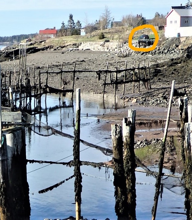
I know I keep talking about the dramatic tides around here, but the SUV in the circle offers a measure of just how far out the water goes twice daily.