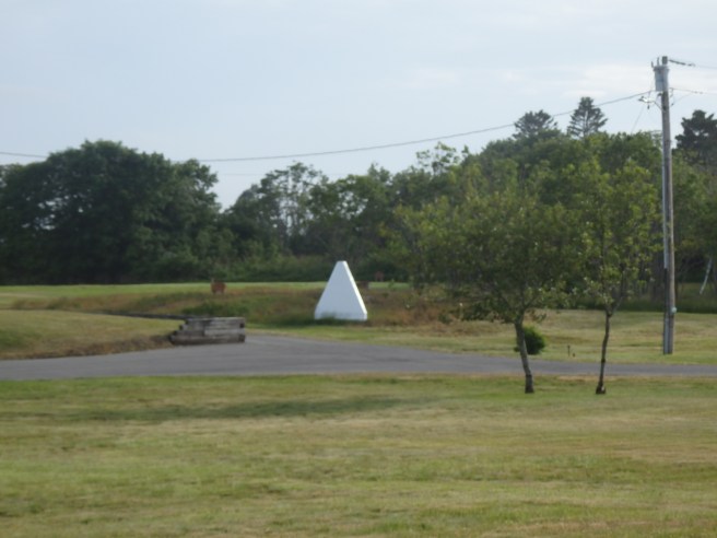
Pyramids like this sit in prominent spots along the shore. They can seem mystifying enough, even before you see a second one nearby.
At last, I learned the two can be lined up to create an imaginary line running out across the water. The border between the United States and Canada falls where the line crosses a similar line running from islands on the other side. That spot can then be connected to others, at least by some kind of maritime surveyors. It’s another example of connect-the-dots.
The four-sided pyramids are called range markers. They’re a special kind of daymark or day beacon, too.
