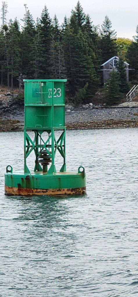
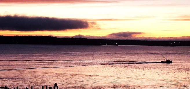
Actually, contrary to what I would note later, I did get out into the wild that summer, just not nearly as frequently as I had hoped.
North Cascades
Summer Solstice
once again
Cornices — the snow overhangs at a mountain crest, hence the classical architectural imitation: capital, shaft, etc.
This trip turned into a pilgrimage to Snyder’s lookout experiences … Marblemount and Desolation Peak are in the mix.
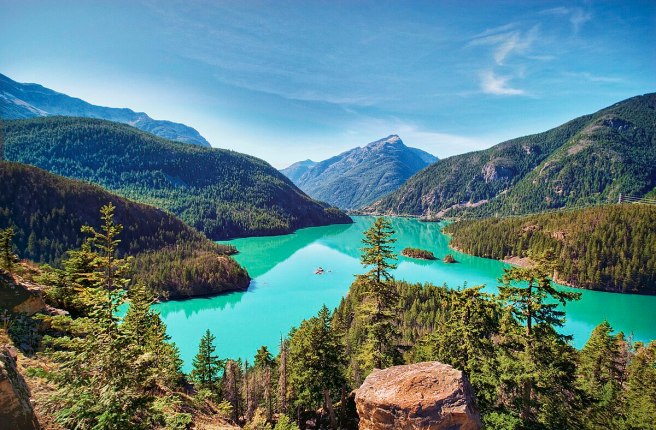
Diablo Lake, in a Wikimedia photo. Ross Lake sits just upstream from it. Their waters really are this color, due to mineral “flour” that washes in.
The cross-state highway closed every winter …
Saw Forest Service packhorses going in at Mazama, two big trucks — up to supply the lookouts? Or pack the guys in?
Smokejumpers Camp and Airport 5
Imagine undertaking a journey where there are no road signs, no maps, no guidebooks — you don’t even know how far to the next town or inn or camp site with clean water. Much less a gas station, restaurant, or motel. You ask people and hope they know.
Now, for a spiritual journey?
23:VI:78
Vacation, at last — too exhausted to do anything (laundry in the washhouse, to free socks to pack) — almost afraid to leave the office, like a mother hen —
Still have to pack up (leave Sunday?), should I read or not? Swing around Montana, Idaho?
Sunday
After going to Thriftway, getting enough food for two weeks in the wild — things I never have at home — got cans of 7-Up, vegetables, soups, juices, puddings …
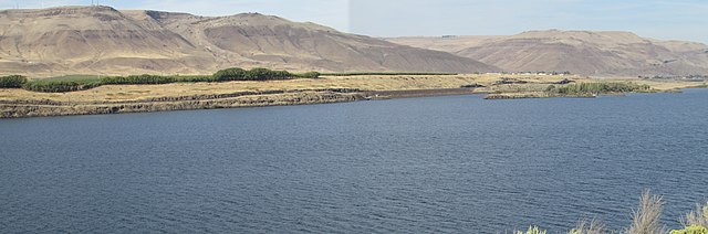
Wandered up along the Upper Columbia with tall alpine jagged escarpments dusted with snow behind and beyond the bunchgrass ridges over Wenatchee …
Hurricane Canyon Orchard …
The Yakima drops about 700 feet between the city of Yakima and the Columbia River — that’s a lot of energy siphoned into the orchards
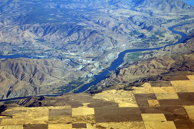
The Columbia River threads past Chelan Falls and the beginnings of Chelan Lake on the left. A few orchards are nestled in along the river just below that. The large blocks are farmlands to the east of the river. Photo by Doc Searls via Wikimedia Commons.
Lady of the Lake, up Lake Chelan (original spelling was something like “Tslain”), leaves 8:30 each morning for Stehekin — barge takes cars up once a week, 8 a.m. Wednesday …
Friends Church at Quincy — half an hour earlier, I would have stopped — in blue jeans, red flannel shirt, and whiskers. [I didn’t yet know what to make with Quakers whose worship includes service by pastors.]
Vacation, reestablishing potential after being pushed against the wall. That is, freedom and cleansing. Leading, giving orders, following routine being functionary of choices already taken by others.
Somehow, the Methow Valley felt much like the trip Moon and I made up to Towanda from Williamsport, Pennsylvania, a forgotten land; here, silver mining gave out by 1890 …
Yet orchards surrounded by six-foot high deer/elk fencing, young trees staked up against the wind; even mature trees supported by lines of wire and fencing …
Twisp, Winthrop decked out as Wild West town — boom town clapboard false-fronts — me, arriving with “what-if” worries about home, such as fire … manuscripts and journals, especially …
Amazement of seeing two solo deer hopping, all four legs still, just the hooves springing all at once.
A single Douglas fir crosscut puts the felled tree at 1,335 years old. Rip ‘em out, they’re gone forever. As long as our up-teen great-great-great-etcetea-grandchildren …
Drove up over Harts Pass (6,206 BM) — nearly camped there in a patch between snow and a table buried within it, but whiteout coming in. Remembering how cold the Hoh was, the year before, along Pacific Coast, pushed on to a site called Chancellor only to find, after a long drive bruising and cutting the tires, the road was washed out. Nearly camped in a secluded spot up there, beside a raging torrent of an icy stream, but noticed a bad cut in my left front tire and realized if it went flat there, I’d been in trouble … [this in the days before cell phones, much less any reception there] …
So back, up and over, to safer sites — of 16 Forest Service sites on the map, only two were open — the third one down was closed by a pile of rocks bulldozed up across the road …
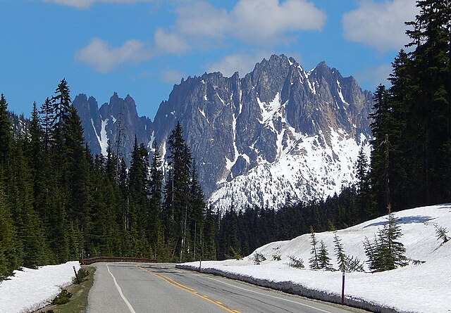
Silver Star Mountain photo by Ron Clausen via Wikimedia.
Monday afternoon, Silver Fir Campground, Baker National Forest
Find a site beside the north fork of the Nooksack River, park my car, cross a footbridge to my tent and table … delightfully royal, sitting here in shorts only, listening to birds and water
[Note that I go off without her … maybe she had classes? No matter, I was free!]
Note of Coal Creek, Soup Creek, and Washboard Creek in the Cascades …
Drove up to the Baker ski area, then hiked six miles in snow up to see Baker, which was hidden behind a high ridge yet once seen, it’s a massive, overpowering, and heavily/thickly glaciated peak … Shuksan, at 9,127 feet about 1,500 feet shorter than Baker, is separated by an incredible chasm …
Hiking, God, how I hate switchbacks! Every step seems like my last (my mature poems, sez Phlum, will be sky blue and hemlock green with a touch of snow at the top).
Climbing to Welcome Pass, hoping this slope (sun-facing) will be snow-free — amazing problem for late June, “trail should be snow-free by mid-August,” booklet description of another path.
During the climb, some great views of Mount Shuksan and its gorgeous pond way below me.
Keep hearing cascades but can’t see the chute —
At the pass, when the forest finally opens up to what should be sub-alpine terrain, I instead face a six-foot deep snow bank … where up from there, the High Divide Trail supposedly takes off — 6,000 feet elevation.
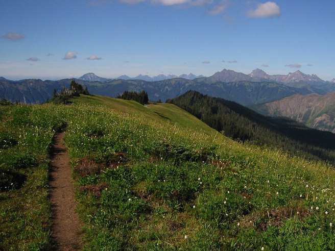
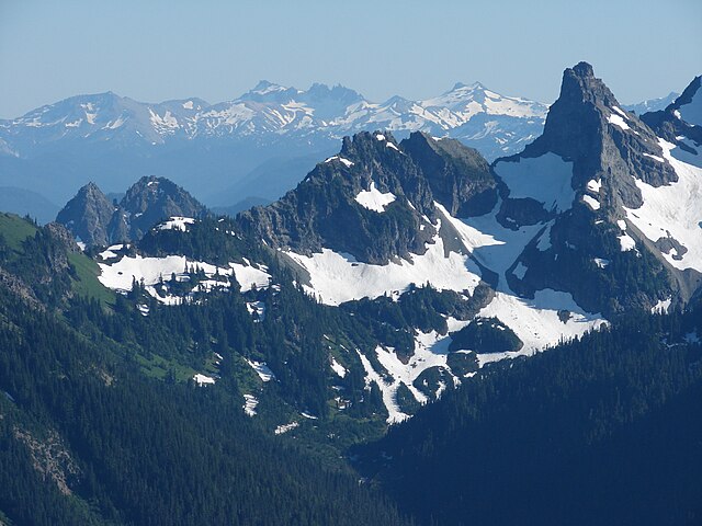
What I saw was something like this photo taken later in the season at Cougar Divide by Walter Siegmund via Wikimedia Commons. The three highest summits on the skyline right of center are Tomyhoi Peak (left, 7451 feet), American Border Peak (8026 feet) and Mount Larabee (right, 7868 feet). The highest peak left of center is Mount McGuire (2019 m) in British Columbia. The long ridge in the middle distance is the High Divide.
As I noted, what I beheld included an unbelievable valley below me to the north — huge glaciers on mountains I can’t identify. One mountain near here has a lookout perched atop; need my binoculars to see it.
Then stumble back down switchbacks — dodn’t see another person the whole trip.
“This is a very steep old miners trail.”
Riprap Creek flows down from Sourdough! (map reading)
28 June (Wednesday)
Realizing I’m 30, the next ten years being (traditionally) the most important in a writer’s career, and yet having the feeling I will stretch that, by shifting at 40, like Brahms from chamber music to symphonies, from poetry to novels (and perhaps a kind of Western, at that, from a much different order)
Flecks of gold in the sand (real gold: there had been a gold rush in this valley in the late 1800s
75- to 80-degree slopes … and they’re heavily forested
The droning of the river isn’t anything like the drone of a motor.
(the latter like an evil dentist dressed in black)
Nothing really matters right now, and that’s strange for me. Haven’t even heard classical music for three days now.
Coming through rainy North Cascades, this time stopping in Diabolo, Sourdough Trail (# whatever), “Sourdough Lookout 5,” thinking it’s been almost 25 years since he was up there (spotted the lookout, a tiny prick on a long monster loaf, snow still deep around it). Thinking how personal his work’s become to me — shit, I hadn’t even begun kindergarten when he was up here, how it would be another dozen years before approval as a national park or 20 before the North Cascades Highway opened (and that being closed each winter by snow) … how accessible all of this has become in the years since: yoga, Zen, too. Along with the setbacks: “14-year-old perfect master,” TM, Hare Krshna.
“a place that seems to have a more interesting past than its present”
30:VI
Home again
Air out sleeping bag, ground cloth, tent
Launder my smoky, sweaty clothes
Unpack and repack: sort through books and maps
So rare to have time to read: that sense of leisure
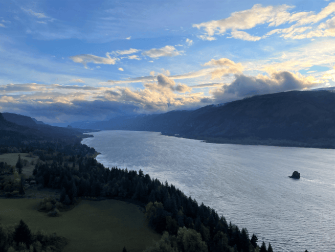
Yesterday, driving nearly 500 miles, a storm along the Columbia — the smell of summer rain and thunder — low clouds swirling, water gray, reminding me of the Hudson … should I have stayed on through the 4th and its mobs?
Rain in the orchard: how beautiful the back porch sounds …
~*~
From Spiralbound Cascadia with commentary.