
Gulls on rockweed
You never know what we'll churn up in cleaning a stall

Within the continental United States, these arctic bogs are found only in Maine, where they’re known locally as heath. These magical openings in the forest host a variety of unusual plants and even rare animals like the crowberry blue butterfly. The forests themselves are often thick with arboreal lichen – Spanish moss – which thrive in the cool temperatures and fog, as well as mossy bog.


The population of Eastport lives mostly on Moose Island, with a few more on Carlow. Both are connected to the mainland by a 1930s’ causeway running to the Passamaquoddy’s Pleasant Point Reservation in the township of Sipayak. Before that, the connection was a toll bridge to Perry.
But these aren’t the only islands within the city limits.

The Maine Trust Heritage Trust includes Treat Island among its preserves open to the public. Settled in 1784 at the juncture of Passamaquoddy and Cobscook bays, it became home to a fishing hamlet of 50 or so families and then a Civil War artillery battery before being acquired by 1935 for a tidal power project that was later abandoned. Treat’s open meadows, cobble beaches, trails, and spectacular views are, however, accessible only by boat – and kayakers are advised to hire a local guide before venturing out on the challenging tidal currents.
Eastport also includes small Dog Island, which once had a lighthouse, but is tucked away in a tony part of town. Again, you get there only by boat.

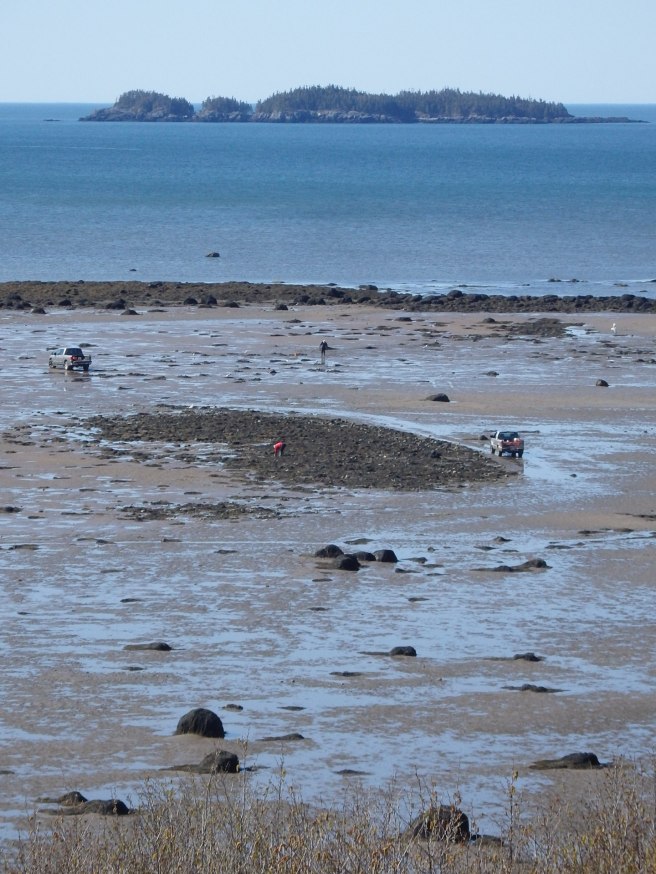
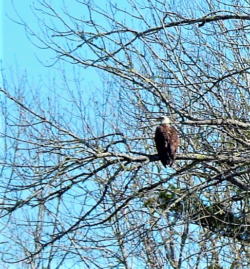
Fourteen-acre Matthews Island, however, sits along Carrying Place Cove and Cobscook Bay, not far from the municipal airport. And you can walk there, if you time it right, while the tide’s out. Just make sure you don’t get stuck by the incoming tide. Another of the Maine Coast Heritage Trust preserves, it’s accessed through a right of way on private property and then an exposed bar.
In the early 1800s, Capt. Charles Matthews raised his eight children here. Today, eagles are raising their own on the north side of the island.


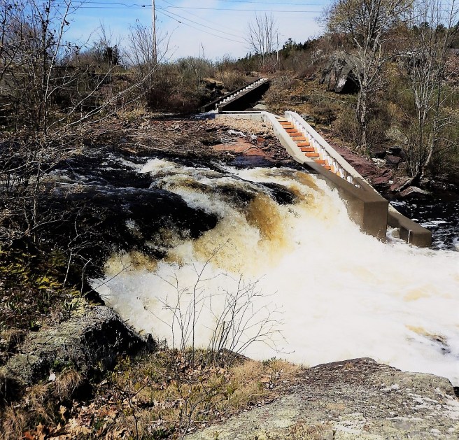


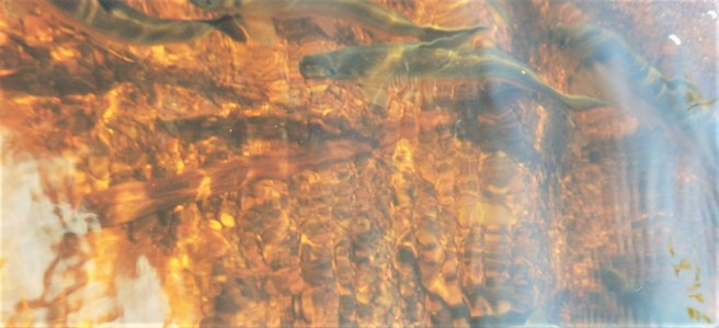
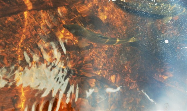
Around mid-May across the New England coast, the alewives migrate en masse upstream to freshwater breeding grounds. Sometimes identified as river herring, they have played a role in the region’s heritage, from Indigenous peoples on.
They still attract fishermen to the riverbanks and bridges, as well as eagles and osprey overhead.
And though bony, many folks consider them a seasonal delicacy, often worked into an appetizer. More commonly, they’re a common lobster bait.


