That record flooding gets personal  

Looking at the news of Vermont’s flood damage, I’m seeing places I know and have traveled. Towns I pass through on my way to and from Quaker Yearly Meeting sessions at Castleton University, for instance, all now heavily hit. I wonder about some of the covered bridges I anticipate visiting or places I stop for a stretch, too.

I’ve been waiting to hear from a dear friend, especially, though I know his home is high above the stream running through town. Still …

My wife and I retain strong impressions from seeing the devastation from Hurricane Irene nine or ten months after it delivered its wallop. You wouldn’t believe the extent unless you saw the evidence.

The mountains become a funnel for the falling water, and many of the roads have nowhere to go but beside the streams. People, of course, live along the roads … many of them at the foot of natural chutes from the hillsides.

It’s not just water, either, but the boulders and gravel it unleashes.

There are real stories that will unfold long after the TV cameras and breaking news headlines have moved elsewhere.

But it does make a difference when events do somehow seem to reflect home for you. Or when you look for what I think of as “slow news.”
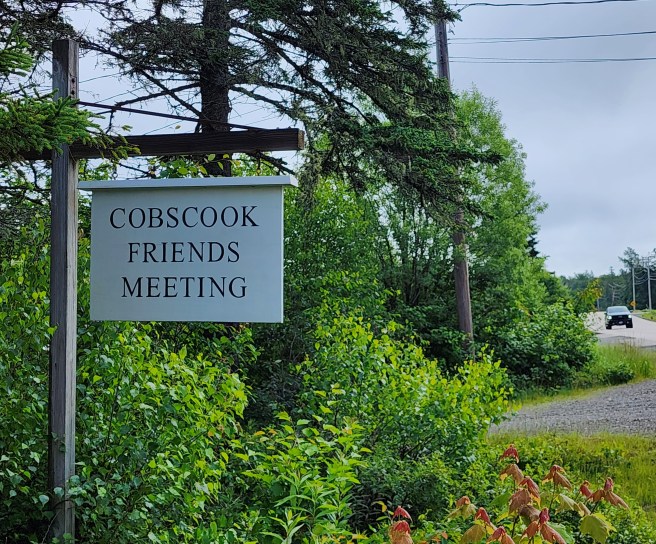
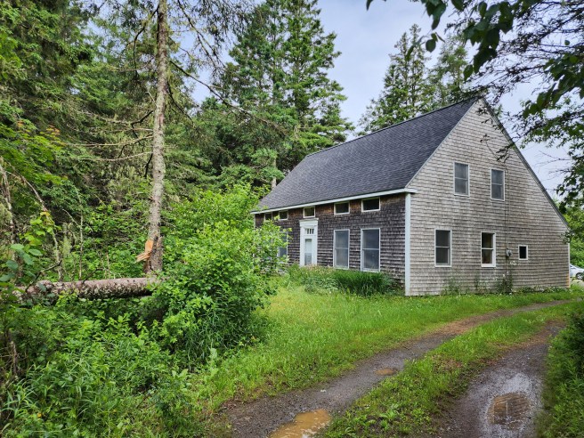
Welcome to Cobscook Friends

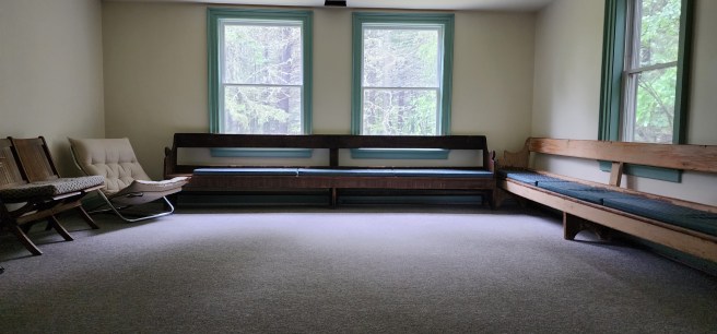
As a small, rural Quaker fellowship, we’re especially happy to be worshipping together in one space every Sunday again, at least through the summer and early autumn.

Covid, of course, had us connected only by Zoom through much of the Covid onslaught and after that, coming together in a physical space on alternative weeks only. We do live at distances from the meetinghouse, so winter weather can often be a challenge.

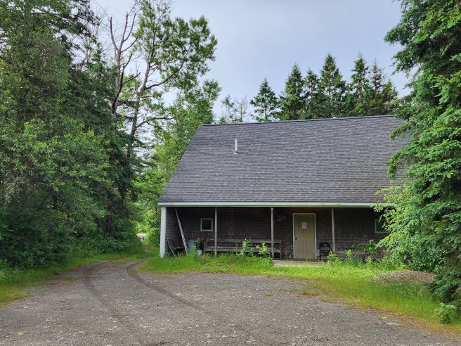
Not so summer. We’d love to have others join us in our hour of mostly silent centering, beginning at 9:30 on Sunday mornings. The meetinghouse is in the woods along Maine Route 189 in Whiting – on the way to Lubec and many great outdoors trails.

If you meditate in some practice, you’ll fit right in – and if that seems foreign, it’s still a great time for personal reflection. I always find it renewing.

Finally, a decent seafood selection Way Downeast

Even though we live a block from the ocean, we’ve been perplexed by the selection of local seafood available in the region’s markets. Or more accurately, it’s lack.

The bigger supermarkets have been a disappointment, and the smaller ones, quite limited.

The best overall selection we’ve found, especially for local catch, is Earle’s SUV that shows up on U.S. 1 down in Machias on selected days. That’s an hour away.

For crab, clams, and scallops, it’s Betty’s seasonal shack in Pembroke, about 20 minutes from home.

Other than that, it’s meant going directly to the fishermen, if you know where they are.

Finally, we’re feeling upbeat. The reopening of Quoddy Lobster’s dining operation, just a block from us, includes a fresh seafood counter.

New owner Look Lobster, a fifth-generation family company in Jonesport, has already invested heavily in the Eastport site by rebuilding the pier for straight-from-the-boat deliveries. Last summer it became my go-to place for fresh retail lobster, especially for anything over a pound and a half.

Now that the end-of-the-street site is serving traditional lobster plates for the first time since Covid, it won’t be long before the outdoor picnic tables by the sea are soon packed with devoted fans. The place, a very popular destination both among tourists and locals, was much missed.

Now, for our big whirlpool

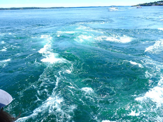
One of Eastport’s travel attractions is the “Old Sow,” the world’s second biggest whirlpool or the biggest one in the Western Hemisphere.

~*~

Before you make reservations to come see it, let me point out a few things.

  1. Its intensity varies greatly, depending on the gravitational tides cycle. It’s best about three hours before high tide, especially around the new and full moons when 40 billion cubic feet of water flood through the half-mile-wide passage to Passamaquoddy Bay.
  2. Its swirling diameter can reach 250 feet or drop 12 feet into its vortex, but it’s also likely to appear as a series of boiling countercurrent piglets and eddies.
  3. Most of the time, it’s not particularly visible from land. It is, however, a regular feature on Butch Harris’ whale watch runs. And even then, it will likely be a disappointment if you’re expecting to see a big hole in the water.
  4. It remains, nonetheless, a hazard to small boaters and has claimed lives, most notably in 1835 when a mother watched from shore as a two-masted schooner was sucked down with her two sons. The young men were never seen again.
  5. Another account, from the late 1800s, tells of two men with a barge loaded with logs, that went under and the bodies never found.
  6. It’s closer to Deer Island, New Brunswick, than Eastport, Maine, in part a consequence of public works construction of a causeway to the north during the Great Depression that pushed the current eastward.
  7. The name likely derives from the mispronunciation of “sough” as “sow” rather than “suff,” reflecting a “sucking noise” or “drain.” Or even “grunting.”
  8. The phenomenon arises from a unique funneling of powerful currents over a sharp trench on the seafloor, with water rising abruptly from 400 feet to 119 feet. It then intersects other trenches to thicken the action.
  9. The upswell brings nutrients and small sea creatures from the depths to the surface.
  10. The channel’s ferocious currents can run six to seven knots, a special hazard for divers as well as small boats.


Making the best of a break in the fog and rain

We’re feeling sorry for vacationers to our end of Maine the past two weeks. Especially those with children in tow.

It’s been cold – our furnace is still on – and very foggy and damp, accompanied by showers and thunderstorms.

It’s not what you’d want to run into on your well-earned summer getaway.

At least we’re getting a break, however brief.

Today’s forecast is for mostly cloudy, followed by two partly cloudy days. And then another solid streak of rainy days resumes.

Glimpses of real sunlight and blue sky will lift spirits, no doubt. I might even stop reminding folks of six straight months or so of this for people living in Seattle. (You know, it could be worse. We might even have to start watching movies in German.)

One thing you can also anticipate is the sound of lawnmowers the moment the grass dries sufficiently. Otherwise, a failure to mow in time can lead to an impossible task, as I remember when I had to learn to scythe back in Dover … and my vow to myself never to do that again.

For us, it also means doing laundry. We have a washer here but not a dryer. So we’re anticipating hanging wet clothes and linens out on the line to dry. There is a backlog to address.

Another must-do is a big round of grilling. Maybe even dining al fresco, if the temperature cooperates.

Well, as we’ve been saying all along, this too will pass.

A few prime strolls around here

Visitors on the street sometimes ask me about good places to hike around here, and looking at them, I don’t always want to recommend anything too strenuous. On my part, I do miss the old carriage road up Garrison Hill back in Dover, New Hampshire, but you can’t beat some of these.

  1. Quoddy Head State Park in Lubec. The parking lot is close to an iconic lighthouse, spectacular bluffs, and an Arctic peat bog. Not a bad combo as an introduction.
  2. Shackford State Park in Eastport. It almost became an oil refinery. The central trail leads to an incredible panorama of Cobscook Bay and a high probability of seeing bald eagles.
  3. Matthews Island. Also in Eastport, this Maine Coastal Heritage Trust site can be reached only at low tide. Getting there will give definitely give you a sense of mudflats. MCHT also has nearby Treat Island, which we intend to explore by renting a water taxi to get us there and back.
  4. MCHT includes other personal favorites, starting with Boot Cove in Lubec. If you like Acadia National Park, you’ll love these lesser known opportunities. Nose around in this Red Barn blog, you’ll find photographic evidence why.
  5. The Bold Coast public lands in Cutler. This is for the serious hiker, one willing to walk 1½ miles to get to the rugged ocean. From there, though, there’s a six-mile breathtaking clifftop trail along the restless ocean, and even primitive camping on a limited first-come, first-served basis at the end. The trailhead parking lot can be overflowing in prime season.
  6. Cobscook Shores. Thanks to a newer family trust, 15 small waterfront sites provide public opportunities for investigation. Most have outhouse or indoor plumbing facilities as well as picnicking, sometimes in screened-in pavilions around a single table. My favorite to date is Morang Cove.
  7. Moosehorn National Wildlife Refuge. So far, I’ve sampled trails at its Baring and Calais district but there is more in Edmunds township. Former roads, now used only for ranger access, make for broad, easy pathways through a variety of ecosystems. My big caveat for inland trails is to be prepared for black flies from late April into July. They can definitely spoil and outing.
  8. Downeast Sunrise Trail, atop an abandoned rail line. I see it primarily as ATV and snowmobiling in season, but it does offer insights in inland ecologies. Again, note the black fly warning.
  9. Mowry Beach in Lubec and Roque Bluffs State Park south of Machias. Sandy beaches in Downeast Maine are rare. Here are two wonderful exceptions for those who want to indulge in a long barefoot walk.
  10. Back in Eastport, the Hillside Cemetery is worth nosing about. It’s newer than many classic New England burial grounds, but the engraved stones add up to some fascinating stories.

With the Canadian border now reopened, I’m looking forward to some treks on Campobello Island, both at the Roosevelt international park and a few other sites.


Have you ever been to Acadia National Park?

Maine likes to tout itself as Vacationland, and Acadia National Park is definitely a star attraction. I know people who gush that it’s their favorite place ever. Not that I’d go that far.

Still, let’s consider:

  1. With four million visitors a year, it’s among the 10 most popular national parks. Most of them crowd in during the prime summer months.
  2. The official version has the park being named after Arcadia, a region of Greece that it supposedly resembles. New France, however, referred to eastern Maine as Acadia before being expelled by the English in 1763. In their migration, some of those Acadians became known as Cajuns down in Louisiana. I’m siding with the French here, despite my fondness for Greek culture.
  3. It was the first national park established east of the Mississippi and encompasses 47,000 acres, mostly on Mount Desert Island. Not that there’s any desert, it’s just wild. Additional, less well-known tracts are on Schoodic Peninsula (my favorite) and Isle au Haut as well as smaller islands. And a fourth of the land total is privately owned but under easements and similar arrangements.
  4. With 108 square miles, Mount Desert Island is the biggest island in Maine and the sixth largest in the contiguous United States.
  5. The park has 158 miles of maintained hiking trails spanning mountainous terrain, panoramic views, rocky Atlantic shoreline, mixed forests, and lakes. Former carriage roads are also popular with bicyclists.
  6. There’s a private trolley service for those who’d prefer to view the scenery more than the traffic jam.
  7. Backcountry camping and overnight parking are not permitted, but there are campgrounds and lean-tos for those who plan well ahead.
  8. French explorer Samuel de Champlain gets the creds as the first European. He encountered the place in September 1604 when his boat ran aground on a rock. He applied the name Isles des Monts Deserts, or island of barren mountains, to the bigger scene. Well, some are pure rockface.
  9. In the 1880s, the island became a summer retreat for Rockefellers, Morgans, Fords, Vanderbilts, Carnegies, and Astors who built elaborate vacation dwellings they called “cottages.” Many of those were destroyed by a vast wildfire in October 1947.
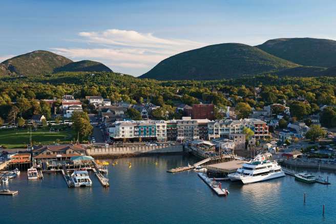
  10. Its principal gateway is Bar Harbor, a city of 5,000 full-time residents that swells with summer people and their second homes, tourists, and often a big cruise ship or two that add several thousand more people to the crowd. Be warned that parking is at a premium in high summer.

For more adventurous souls, let me suggest exploring two hours to the east, to the Bold Coast, for a less spoiled alternative.

We’re even part of the famed Bay of Fundy

Maybe you’ve heard of it, the place of the world’s most extreme tides, up to 53 feet every six or so hours, meaning about six feet hourly on average or up to 12-plus in certain time windows.

If you swim, you know that’s way over your head.

So here’s a little perspective.

  1. Most U.S. maps cut out nearby Canada, leaving little sense of how much lies east of Maine and not just north. That’s anything beyond Portland, essentially, yet not that far north of Boston.
  2. Typically excised from maps of Maine, the big island of Grand Manan is essentially as lengthy as Martha’s Vineyard but with much more substantial cliffs and an undeniably working fisherman economy. To get there, you need a ferry hop or two from Canada. And that’s saying nothing of its craggy inhabitants. It’s definitely on my bucket list.
  3. Technically, I dwell on one of the subsidiary waters. Fundy Bay itself is about 55 miles wide just south of here, pointing to another place renowned for its scallops. Or is that also east? In other words, Fundy’s big.
  4. The bay’s positions of Maine and New Brunswick, on one side, and Nova Scotia, on the other, act as a funnel that intensifies Atlantic currents in and out of the channel. It’s a long story but likely worthwhile for certain nerds, especially once you see how it shapes up on the dinner plate. The intensity of the record tides does have some techies well as others drooling.
  5. That leads to the possibilities of electrical generation. Mainers would definitely welcome a reduction in our electrical bill. Wind, solar, and tidal power generation are all rising as important sources.
  6. We are mused by one local craftsman who proclaims her studio the Clay of Fundy. She’s hardly alone. You’d be amused or quite critical of the range of wordplay prompted by the Fundy word.
  7. It has rivers that reverse their flow, a phenomenon known as tidal bore.
  8. The bay can report up to ten kinds of whales every summer.
  9. For water to get from the mouth of the bay to its crown can take up to 13 hours.
  10. Its ecosystem is said to rival the Amazon’s. Just ask scuba divers.


Pemaquid, out beyond the Piscataqua frontier

Call it a serendipitous trip.

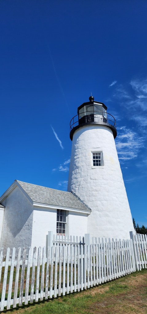
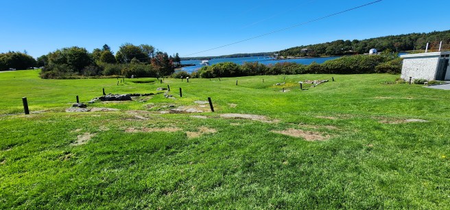
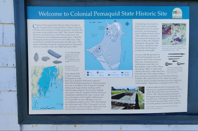
My stopping off at the Colonial Pemaquid historical site in Maine during a weekend at the Common Ground Country Fair last year was an impromptu decision. I’d made a side trip to visit the iconic lighthouse down on Pemaquid Point in midcoast Maine and saw a roadside sign and thought, what the heck, on my drive back.

After all, the settlement had some connections to early Dover, as I note in my new book, but simply setting foot there gave me a more substantial sense of the place than as a footnote vaguely out there somewhere up the coastline.

At first, the state-managed site appears rather modest. Its small museum and nearby seafood restaurant were both closed, this being the shoulder season. But nosing around revealed much, much more, as I’ll explain here and in some upcoming posts.

It was settled by West Country fishermen, like those who were pivotal in early Dover, shortly after Edward Hilton and Thomas Roberts set up shop along the Piscataqua, so they would have shared a common culture. Notably, both sites were established before the great Puritan migration into Massachusetts Bay, bringing a much different English culture into New England.

Unlike Dover, the Pemaquid village was destroyed repeatedly in attacks from the French and their Native allies in the decades from King Phillip’s war on.

In short, English settlement was erased from Maine all the way down to Wells and York, close to Dover. I have to admit that caused me to give lesser attention to settlement much to the east of the Piscataqua River.

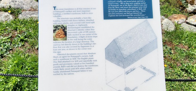
Still, the Pemaquid site, now in the town of Bristol, was left relatively undisturbed after the late 1700s. In the 1990s, though, extensive archeological excavations determined the shape of the village and a gave a clearer understanding of its economy and lifestyle. Today, the stone foundations and interpretative signage present some of their findings.

In those, as I’m excited to see, I got a clearer sense of how early Dover may have also emerged along High Street – today’s Dover Point Road.