Apart from a short spur to the Portsmouth Naval Shipyard, all of the railroad traffic to and from Maine and the rest of the United States runs through Dover. (I’m not sure how much, if any, goes through Canada.)
When we first moved into the house, our younger one started complaining about all the train noises in the night as sand and gravel moved to Boston’s Big Dig construction.
More recently, one my my regrets about the Covid shutdown has been that a number of Amtrak trips I’d hoped to take – to museums and the Boston Symphony’s Friday matinee concerts, especially – instead got scrubbed. And since the Amtrak station was in walking distance of our house, I loved joking about walking to Boston. Ha-ha.
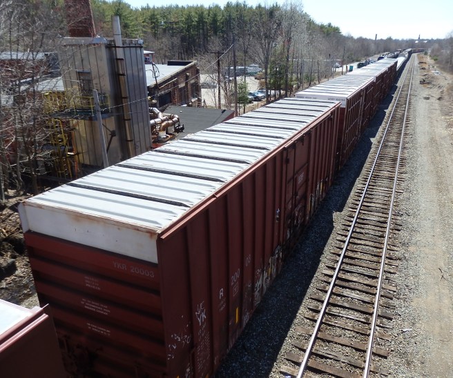
On the other hand, it can be annoying when you get stuck at a railroad crossing downtown while a long freight train passes. I usually lose count somewhere around 120 cars.
Here’s one I managed to shoot from the Oak Street bridge as it waited for the all-clear to continue rolling. Rail traffic, I’ve heard, doesn’t go north-south but rather east-west. Well, Portland’s north of us and Boston’s south. Make of it what you will.

Can’t see the engines up front, can you?