Bloomington has brightened so much: the new public library, buses, Dunkirk Square, Musical Arts Center and Glenn Black Laboratory …
That Tuesday afternoon [December 10] when I went for “a little hike,” over the hill, “to catch the sunset” … sink holes all over, found a dirt road “Xmas Trees ¼ mile” and took it past forest and a bottomless gorge and on and on … taking the next left actually took me further astray, until finally, I passed a few houses and asked someone, “Excuse me, how do I get to Leonard Springs Road?”
He either laughed or looked at me as a dope.
“It’s right here.”
I didn’t get home till 7, well after dark. Kat was very worried, actually went out looking for me.
Turns out my little walk was 7½ miles. “Around the block.”
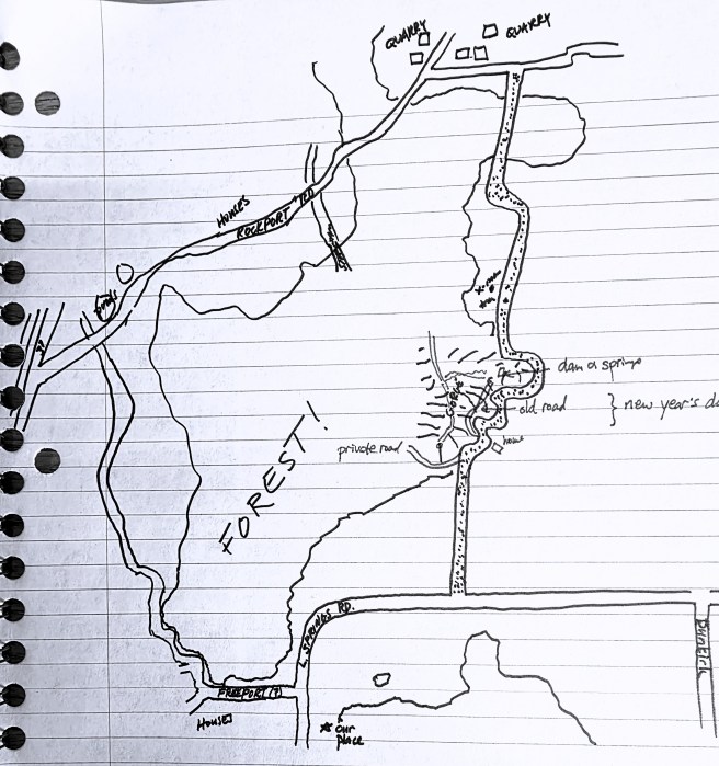
I drew a map, which I later filled in with details.
[Gee, don’t think I had another walk like that till Marconi Station on Cape Cod decades later.]
~*~
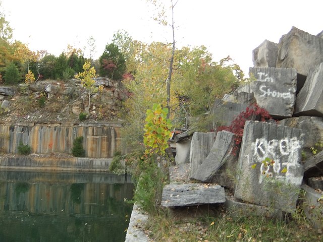
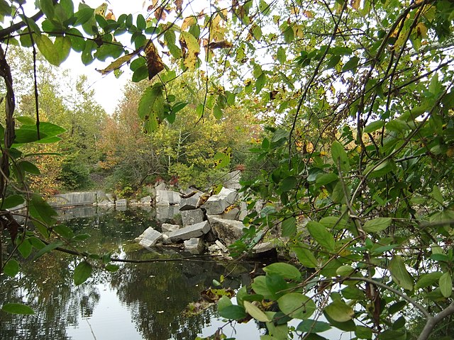
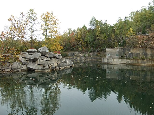
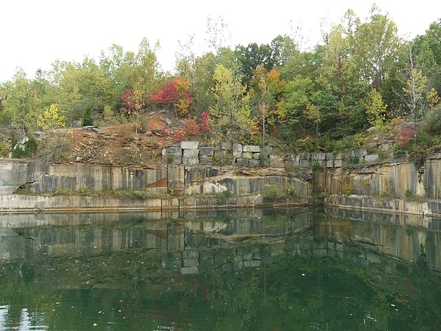
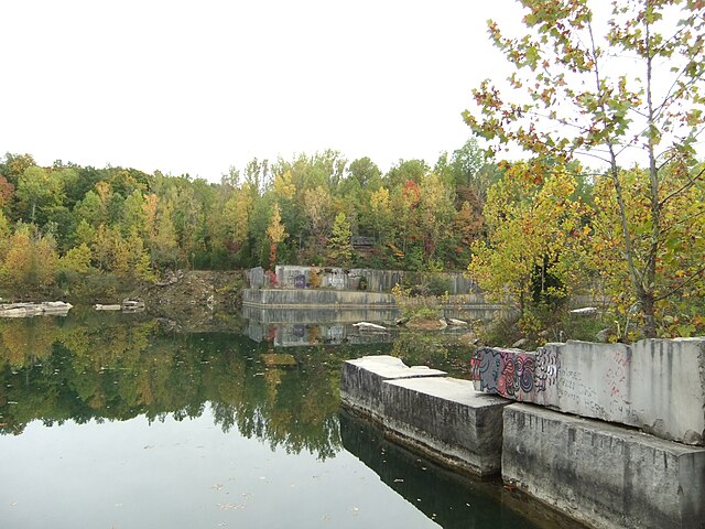
One of the things I encountered on that walk was abandoned limestone quarries, which I would soon view as common features tucked away in the woodlands beyond town. They typically flooded in. Here’ are some examples by Vmenkov via Wikimedia Commons.
~*~
Other explorations? A long drive, including Spring Mill [Madison?], Paoli, West Baden Springs, Washington, Amish country, and Bloomfield. But we were back home by 5 and had dinner at Michaelangelo’s up the street on our side of town.
A mention here of Mennonite, though I still knew next to nothing about the faith. We did pass two lovely white-frame, clear-window, “severely simple” meetinghouses, no name attached. The second had an outhouse behind.
Windmills gave the Amish away, before the lack of utility lines did.
White houses and barns.
Clotheslines in January: solid, somber colors or white.
The radiant face of a middle-aged woman on a buckboard who turned to us and waved.
That woman’s face stuck in my mind.
In its first decades, Paoli was known as a Quaker town, the seat of Orange County, named for the one in North Carolina. Included Lick Creek (later Paoli), Newberry, and Beech Grove Friends meetings.
So much Greek Revival / Greek Temple Revival through southern Indiana.
What struck me was the order – mathematical, geometric, classical – of Paoli in its design and construction. A step beyond the state of log-cabin and rough-cut stone development at Spring Mill as wealth built up into brick homes.
The old wire bridge across White River at Hindoostan: farm-style fencing rather than railing along the sides, three boards on each side as a single lane over a flooded river, in places too widely spaced for our Bug, in others, the bottom boards have broken through. Unbelievable, looking back, that we made it.
Hindoostan settled 1818, vacated 1828: “terrible death” outbreaks of Yellow Fever or cholera. Never resettled. Bluffs nearby.
More formally, Hindoostan Falls. Originally on the stagecoach route.
Nearby, in forest: “Greenwich, 1778, first – in Indiana.” Didn’t get that vital part in driving past.
Vincinnes, founded 1732[!]
Clarksville, founded 1784 by George Rogers Clark, Indiana’s oldest American community; the man hated Indians and wished them all exterminated.
Patoka, 1789.
New Albany, on the Ohio River, was state’s largest city in 1840.
Madison, also on the river, founded 1805, was largest city in 1850.
New Harmony, originally a commune, 1814.
~*~
Spring Mill State Park, an 1816 village of log cabins and a great stone mill a marvelous beauty. Caves and sinkholes all over. As a kid, my family camped there several times.
The great eerie hall of Baden Springs. Decay, the polish gone, earth sinking, buildings crumbling: “new hotel” built in 1901 after fire claimed the first. Who would want to wear a suit and tie while on vacation, even to gamble? As for the waters of the spa? Such formalities!
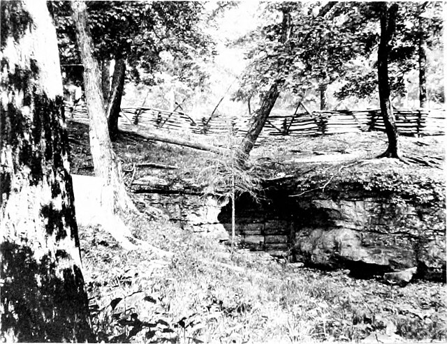
Caves as vertical shafts of cold air rising and fogging in an otherwise barren field: 66 recorded caves and pits in Monroe County, meaning around our home.
US 150, approximate site of ancient buffalo trail from Louisville to Vincinnes, in 1840 became Indiana’s first toll road. Meaning the earlier ones were private?
Lost River: out and then back into the earth, blind fish and crayfish, endangered by flood-control projects (Orangeville).
Back from the road, facing a creek and hillside, Union Primitive Baptist Church, plain cars still there at 1 p.m. Two doors, men’s and women’s. Plus outhouses.
Further on, Hebron Valley Baptist, 1822.
The eerie silence of caves in a fog: “Do not enter this pit without permission.”
Not sure quite where:
Three caves, two days – strange beauty of the muddy sculptural underworld. The twisting rooms, cold reflective water returning whatever light we introduce. Dripping from ceiling.
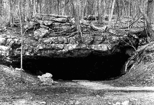
Southern Indiana is laced with caves, including Mayfield’s situated a couple of miles from our home, not that you could see it. Photo from 1907 by Arthur Mangun Banta via Wikimedia Commons. Wyandotte was another, public domain image via Wikimedia Commons.
~*~
Brown County thick with stupid gawking, the contrast of neatly-creased shorts and black Orlon socks and oxfords gawking at rural life and earlier eras punctuated by rough log cabins.
~*~
From Spiralbound Hoosier, with commentary from now.
