A few prime strolls around here

Visitors on the street sometimes ask me about good places to hike around here, and looking at them, I don’t always want to recommend anything too strenuous. On my part, I do miss the old carriage road up Garrison Hill back in Dover, New Hampshire, but you can’t beat some of these.

  1. Quoddy Head State Park in Lubec. The parking lot is close to an iconic lighthouse, spectacular bluffs, and an Arctic peat bog. Not a bad combo as an introduction.
  2. Shackford State Park in Eastport. It almost became an oil refinery. The central trail leads to an incredible panorama of Cobscook Bay and a high probability of seeing bald eagles.
  3. Matthews Island. Also in Eastport, this Maine Coastal Heritage Trust site can be reached only at low tide. Getting there will give definitely give you a sense of mudflats. MCHT also has nearby Treat Island, which we intend to explore by renting a water taxi to get us there and back.
  4. MCHT includes other personal favorites, starting with Boot Cove in Lubec. If you like Acadia National Park, you’ll love these lesser known opportunities. Nose around in this Red Barn blog, you’ll find photographic evidence why.
  5. The Bold Coast public lands in Cutler. This is for the serious hiker, one willing to walk 1½ miles to get to the rugged ocean. From there, though, there’s a six-mile breathtaking clifftop trail along the restless ocean, and even primitive camping on a limited first-come, first-served basis at the end. The trailhead parking lot can be overflowing in prime season.
  6. Cobscook Shores. Thanks to a newer family trust, 15 small waterfront sites provide public opportunities for investigation. Most have outhouse or indoor plumbing facilities as well as picnicking, sometimes in screened-in pavilions around a single table. My favorite to date is Morang Cove.
  7. Moosehorn National Wildlife Refuge. So far, I’ve sampled trails at its Baring and Calais district but there is more in Edmunds township. Former roads, now used only for ranger access, make for broad, easy pathways through a variety of ecosystems. My big caveat for inland trails is to be prepared for black flies from late April into July. They can definitely spoil and outing.
  8. Downeast Sunrise Trail, atop an abandoned rail line. I see it primarily as ATV and snowmobiling in season, but it does offer insights in inland ecologies. Again, note the black fly warning.
  9. Mowry Beach in Lubec and Roque Bluffs State Park south of Machias. Sandy beaches in Downeast Maine are rare. Here are two wonderful exceptions for those who want to indulge in a long barefoot walk.
  10. Back in Eastport, the Hillside Cemetery is worth nosing about. It’s newer than many classic New England burial grounds, but the engraved stones add up to some fascinating stories.

With the Canadian border now reopened, I’m looking forward to some treks on Campobello Island, both at the Roosevelt international park and a few other sites.


Have you ever been to Acadia National Park?

Maine likes to tout itself as Vacationland, and Acadia National Park is definitely a star attraction. I know people who gush that it’s their favorite place ever. Not that I’d go that far.

Still, let’s consider:

  1. With four million visitors a year, it’s among the 10 most popular national parks. Most of them crowd in during the prime summer months.
  2. The official version has the park being named after Arcadia, a region of Greece that it supposedly resembles. New France, however, referred to eastern Maine as Acadia before being expelled by the English in 1763. In their migration, some of those Acadians became known as Cajuns down in Louisiana. I’m siding with the French here, despite my fondness for Greek culture.
  3. It was the first national park established east of the Mississippi and encompasses 47,000 acres, mostly on Mount Desert Island. Not that there’s any desert, it’s just wild. Additional, less well-known tracts are on Schoodic Peninsula (my favorite) and Isle au Haut as well as smaller islands. And a fourth of the land total is privately owned but under easements and similar arrangements.
  4. With 108 square miles, Mount Desert Island is the biggest island in Maine and the sixth largest in the contiguous United States.
  5. The park has 158 miles of maintained hiking trails spanning mountainous terrain, panoramic views, rocky Atlantic shoreline, mixed forests, and lakes. Former carriage roads are also popular with bicyclists.
  6. There’s a private trolley service for those who’d prefer to view the scenery more than the traffic jam.
  7. Backcountry camping and overnight parking are not permitted, but there are campgrounds and lean-tos for those who plan well ahead.
  8. French explorer Samuel de Champlain gets the creds as the first European. He encountered the place in September 1604 when his boat ran aground on a rock. He applied the name Isles des Monts Deserts, or island of barren mountains, to the bigger scene. Well, some are pure rockface.
  9. In the 1880s, the island became a summer retreat for Rockefellers, Morgans, Fords, Vanderbilts, Carnegies, and Astors who built elaborate vacation dwellings they called “cottages.” Many of those were destroyed by a vast wildfire in October 1947.
  10. Its principal gateway is Bar Harbor, a city of 5,000 full-time residents that swells with summer people and their second homes, tourists, and often a big cruise ship or two that add several thousand more people to the crowd. Be warned that parking is at a premium in high summer.

For more adventurous souls, let me suggest exploring two hours to the east, to the Bold Coast, for a less spoiled alternative.

Let’s crack into shellfish

We’re too far north to harvest oysters, at least for now. Ours come mostly for midcoast Maine. But our Downeast waters are famed for their scallops and other shellfish.

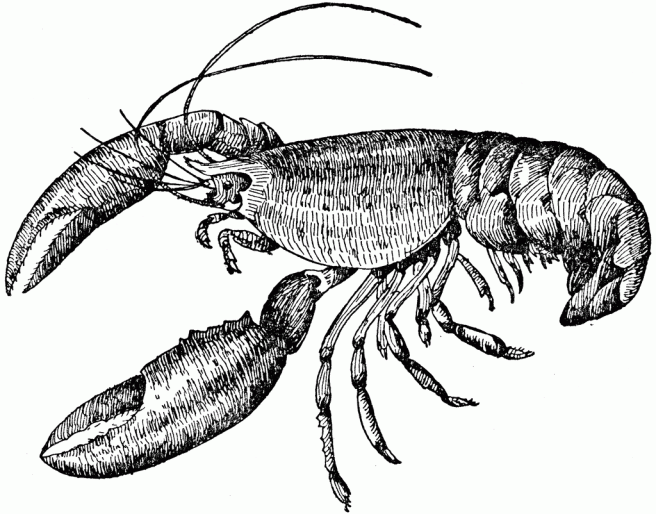
Last year, a Tendrils focused on lobsters, and I’m thinking of a few others in that vein looking ahead.

So today, let’s look at shellfish more broadly. You know, things like the fact they’re spineless and have hard shells. Now, for a few specifics, working around the fact that scientifically, they’re classified in three groups.

  1. Mollusks include snails, clams, mussels, scallops, oysters, octopus, cuttlefish, squid, slugs, and abalone. They form the second-largest phylum of invertebrates, making up 23 percent of the named marine organisms and also widespread in freshwater and terrestrial environments. The oceanic ones are usually very tiny.
  2. The expression of “happy as a clam” is more accurately understood in its fuller version, “happy as a clam at high water.” Or should that be “high tide”?
  3. The chemistry of creating their calcium-rich calcareous shells remains largely mysterious. Chalk, for one, is comprised of their deposits.
  4. But some of them, especially the larger species, have no bones at all. Can they even be considered shellfish?
  5. The second group, crustaceans, includes lobsters, crabs, shrimp, crawfish, krill, and barnacles. They come with a segmented body, two pairs of antennae, and a tough, semitransparent exoskeleton. That chitinous covering is something they have in common with butterflies, crickets, beetles, and caterpillars.
  6. A single shrimp can lay a million eggs. Of course, humans are far from alone in having a fondness for a shrimp dinner.
  7. Crabs communicate by thumping their claws and drumming in a kind of Morse code.
  8. And finally, echinoderms, which are found as adults on the sea bed at every depth. They include starfish, sand dollars, sea urchins, and sea cucumbers. They’re recognizable by their radial symmetry.
  9. In general, shellfish blood is blue, not red, because it relies on copper, rather than iron. And many shellfish rely on plankton for their diet.
  10. My favorite shellfish all seem to go well with melted butter and lemon.

There’s more to the legacy of New Hampshire’s Hiltons

While Edward Hilton is hailed as the father of New Hampshire and was early on joined by his older brother William, both drifted away from my history Quaking Dover. Still, some points of interest remain.

Among them:

  1. His son, Edward Hilton Junior, married Anne Dudley, daughter of Puritan minister Samuel Dudley, allying his line with a prominent early New England family in Exeter. I sense there’s much more to this union that is presented.
  2. Edward’s grandson, Colonel Winthrop Hilton, was slain by Natives in 1710 while harvesting mast trees in Epping. He had succeeded Richard Waldron as head of the New Hampshire militia. His other grandfather was Massachusetts governor John Winthrop. So much for high connections.
  3. Winthrop Hilton’s brother Dudley was carried off in the attack and never heard from again.
  4. Edward’s nephew Captain William Hilton mapped an island in South Carolina in 1663, naming the location Hilton Head Island. He also mapped Cape Fear that year. He sailed out of Charlestown on Boston Harbor but acknowledged finishing the maps in the home of Nicholas Shapley in Maine – that is Shapleigh, a major figure in my book. Just look at Billy’s uncle’s second wife.
  5. That is, the elder Edward’s second wife, the widow Katherine Shapleigh Treworgy, who had a daughter marry into the equally prominent Gilman family.
  6. Into the late 1900s, one line continued to live on the farm settled in Newmarket around 1630. In fact, they claimed it was the oldest homestead in the state.
  7. Descendant Daniel Hilton, born in 1794, removed from Newmarket to Meredith, where he had 18 children and left an estate of 80,000 acres by the time of his death in 1867. His ancestry also included Thomas Wiggin, who had brought many of the first wave to settle in Dover after the Hiltons.
  8. Daniel’s son Charles became chief engineer of the New York Central railway, in charge of the building of bridges over the Hudson River and a viaduct in Albany in addition to Grand Central Station and grain elevators in New York City. So much for humble Granite State beginnings. He was also a high-ranking Free Mason.
  9. The Hilton family burial ground along State Route 108 in Newfields, just across the town line from Newmarket, rather thickens the plot.
  10. There’s no connection to Conrad Hilton and his hotel chain.


We’re even part of the famed Bay of Fundy

Maybe you’ve heard of it, the place of the world’s most extreme tides, up to 53 feet every six or so hours, meaning about six feet hourly on average or up to 12-plus in certain time windows.

If you swim, you know that’s way over your head.

So here’s a little perspective.

  1. Most U.S. maps cut out nearby Canada, leaving little sense of how much lies east of Maine and not just north. That’s anything beyond Portland, essentially, yet not that far north of Boston.
  2. Typically excised from maps of Maine, the big island of Grand Manan is essentially as lengthy as Martha’s Vineyard but with much more substantial cliffs and an undeniably working fisherman economy. To get there, you need a ferry hop or two from Canada. And that’s saying nothing of its craggy inhabitants. It’s definitely on my bucket list.
  3. Technically, I dwell on one of the subsidiary waters. Fundy Bay itself is about 55 miles wide just south of here, pointing to another place renowned for its scallops. Or is that also east? In other words, Fundy’s big.
  4. The bay’s positions of Maine and New Brunswick, on one side, and Nova Scotia, on the other, act as a funnel that intensifies Atlantic currents in and out of the channel. It’s a long story but likely worthwhile for certain nerds, especially once you see how it shapes up on the dinner plate. The intensity of the record tides does have some techies well as others drooling.
  5. That leads to the possibilities of electrical generation. Mainers would definitely welcome a reduction in our electrical bill. Wind, solar, and tidal power generation are all rising as important sources.
  6. We are mused by one local craftsman who proclaims her studio the Clay of Fundy. She’s hardly alone. You’d be amused or quite critical of the range of wordplay prompted by the Fundy word.
  7. It has rivers that reverse their flow, a phenomenon known as tidal bore.
  8. The bay can report up to ten kinds of whales every summer.
  9. For water to get from the mouth of the bay to its crown can take up to 13 hours.
  10. Its ecosystem is said to rival the Amazon’s. Just ask scuba divers.


And now for Lubec

I’ve been posting a lot about Eastport and nearby scenes but said little to date about the neighboring communities here in Way Downeast Maine.

So today I’ll turn the spotlight to a town to our south, one we easily see from the Breakwater and other points in Eastport. It also sits across the water to our west. Despite the proximity, driving between the two takes nearly an hour.

Lubec as seen from Campobello Island, New Brunswick.

~*~

Here are a few additional facts.

  1. It’s pronounced “LOO-beck,” named for Lubeck, Germany.
  2. It has roughly the same (small) population as Eastport but is organized as a town rather than a city. That’s why it can claim to be the easternmost point in the continental U.S., while E’port struts about being the easternmost city. It’s a hairline difference.
  3. Lubec’s also the closest location in the continental U.S to Africa. Yes, way up here nearly on the 45th parallel, halfway to the North Pole, rather than say Virginia or tropical Florida.
  4. Set on a peninsula, the town has more water than land.
  5. With its Quoddy Head State Park and the iconic peppermint-pole lighthouse, Lubec can be seen as the gateway to the Bold Coast trailheads that provide access to spectacular shoreline and bluffs. It’s like Acadia National Park without the crowds.
  6. It also has a “sparkplug” lighthouse in the water south of downtown and faces the Mulholland lighthouse on the Canadian side of Quoddy Narrows.
  7. Speaking of Canada. Neighboring Campobello Island, New Brunswick, is home to the Franklin Roosevelt International Park, originally the family’s summer “cottage” and compound and then Eleanor’s favorite home. Today the historic site covers five square miles that include trails of shoreline and forest. To get there, you have to drive through Lubec.
  8. SummerKeys is a kind of music camp for adults, mixing skill levels from beginning amateur to skilled professionals into a lively and supportive environment. Free weekly concerts in the Congregational church are a highlight for the rest of us.
  9. While statics are unavailable, one friend tells of a summer when every day in Lubec was beset by heavy fog. She’s made it sound unbroken. I have been in town on several afternoons when the place was quickly socked in the dense gray invasion, and from Eastport I’ve often seen its thick steely blanket roll over the downtown at the fringe of our view before inching up the water toward us. Another friend tells of the common frequency of heavy winds. Either way sounds harsher than what I’ve encountered in nearby Eastport.
  10. The town no longer has a high school. When it did, athletic events between Lubec and Eastport were often followed by fights.


Let’s haul on some sea chanteys

As I’ve previously noted, the work songs went into the woods in the winter, carried by sailors who came ashore for the season. But few songs in return migrated from the forests to the sea.

Women’s names could be a clue to the, uh, moral integrity of many messages. “Sally” or “Nancy,” for instance, some more sterling than others.

Other work songs include chain-gang ditties or even the racist, “Zip-a-dee-doo-dah,” though it might fit what’s become of the minimum-wage American workplace.

As for spellings, I’m sticking with “chantey,” based on a scholarly friend’s insistence the notes having a chanter setting the pace. “Shanty” and “chanty,” though, are more common.

Here are some related facts.

  1. This folk music genre flourished aboard larger merchant vessels of the 19th century as a means of setting a rhythm to optimize joint labor involved in either a pulling or pushing motion, such as lifting anchor or setting sail, tasks that required working together for a long time. Think of circling a capstan. Think “Heave!” Or “Haul!”
  2. That’s why many of them are about whaling.
  3. The tradition soared in the period between the War of 1812 and the Civil War and died out with the arrival of steam-powered ships.
  4. Its roots, though, go way back through earlier work songs around the world, including stevedores loading and unloading ships.
  5. Some of the chanteys originated with African-Americans performing “cotton-screwing” on shore, using a large screw-jack to compress and bale cotton for shipment from Southern ports. Some of the incomprehensible words in the songs are attributed to this.
  6. Essentially, it’s a call-and-response form between the solo chantey man and the work crew.
  7. Sometimes they were accompanied by a bosun’s pipe, fife, drum, or fiddle.
  8. They were sung by pirates, too.
  9. About 200 were set down on paper, but thousands more were likely lost.
  10. Some may have been used when relaxing in the evening.


You may have noticed I’m fond of ferns

I don’t remember them being common in the woods when I was growing up in the Midwest, but I’ve become fond of them since. I even devoted years to developing a fern bed beside our “smoking garden” patio at our home in Dover. At least now we’re surrounded by fabulous ones in the wild here.

Oh, yes, I’ve finally tasted fiddleheads in the springtime and like their taste almost as much as asparagus.

Here some additional facts.

  1. They predate the dinosaurs. One variety, the cinnamon fern, looks the same today as it does in 70-million-year-old rock fossils.
  2. They don’t have flowers or seeds and don’t have leaves. Those lovely green fronds are actually branches fused in one plane.
  3. They reproduce via spores rather than seeds. Spoors usually look like small dots on the undersides of the fronds. A single plant can drop millions of spoors on the ground, but few find favorable conditions.
  4. Some species are parasites, growing not from the ground but on decaying tree trunks on the ground or in pockets overhead.
  5. Their roots descend from rhizomes, a below-the-soil, horizontal stem that can range from very thin and creeping to thick and stocky.
  6. Some plants survive up to 100 years.
  7. Bracken ferns can live without any sunlight.
  8. Most ferns are resistant to cold but many also thrive in tropical zones.
  9. They make lovely houseplants that require little care. They do, however, need higher humidity than is commonly available, especially when the furnace is running.
  10. They can remediate contaminated soil and remove some chemical pollutants from the air.


Among the reasons for Quaker decline, let me suggest

Relocation to the West, especially, wasn’t the only reason Dover Friends Meeting in New Hampshire declined in the 1800s. Here are a few other factors.

  1. Being Quaker can be hard work. Not just a Sunday thing. Things like honesty.
  2. Tightening of personal discipline in the mid-1700s. The marriage restrictions definitely cut into membership.
  3. Plainness in clothing, design, and possessions. That is, personal expression.
  4. Employment and other business ethics. Refusal to take oaths kept Friends out of some professions, such as the law, and bankruptcy was a disownable offense.
  5. No “vain entertainments.” And thus, no music, dancing, fiction, theater, paintings, card playing, horse racing, or gambling.
  6. Pacifism during the Revolutionary and Civil wars, plus withdrawal from political offices in the 1760s.
  7. The separations that split the Society of Friends into factions from the 1820s on.
  8. Aversion to emotion, starting with anger.
  9. Emerging restrictions on alcohol and tobacco. Being “disguised by hard liquor” was a big problem on the frontier.
  10. Even the appearance of wrongdoing could be an offense. And all that led to deadly quaintness.

Not that these quite apply today. Still, they could prompt a book in themselves. For now, you’ll have to consider Quaking Dover for the story. Order your copy at your favorite bookstore. Or request it at your public library.

Black flies, little black flies

Spring in Maine can be a very short season, marked first by mud season and then the black flies that descend from late April into July.

My introduction came one year in a brief stop to investigate a stunning waterfall, interrupted by a large swarm of what I thought were mosquitos. The second enlightenment came at a stop along the Airline Highway en route to Eastport. A wall of flying insects would be a diluted version.

Also known as buffalo gnats, turkey gnats, or white socks (not of the Chicago baseball kind), black flies are more than the defenders of wilderness. Take a look.

  1. They don’t seem to be a problem on windy days or along the ocean.
  2. There are actually more than 2,200 species of them, not that the ones I’ve seen ever look black.
  3. Their bites are particularly nasty or, at the least, a nuisance. Some even spread the disease river blindness.
  4. They’re found far beyond Maine. Scotland, northern Ontario, and Minnesota weigh in heavily, though Pennsylvania has been active in the battle against them.
  5. The eggs are laid in running water and are extremely sensitive to pollution.
  6. Bites are most often found on the face, hairline, neck, and back, though the pests are attracted to breathing and, thus, can enter the nose or mouth. Don’t overlook the ankles, either.
  7. They’re attracted to dark colors.
  8. They stretch the skin and then make shallow cuts with blade-like sections of their mouth before sucking blood.
  9. They’re most active for a few hours after sunrise and a few hours before sunset but totally inactive through the night.
  10. Folksinger Bill Staines made a hit of the logging camp song written by Canadian Wade Hesmworth. The line, “I’ll die with a blackfly pickin’ my bones,” rings especially true.