A RIVER CRUISE FOR PERSPECTIVE

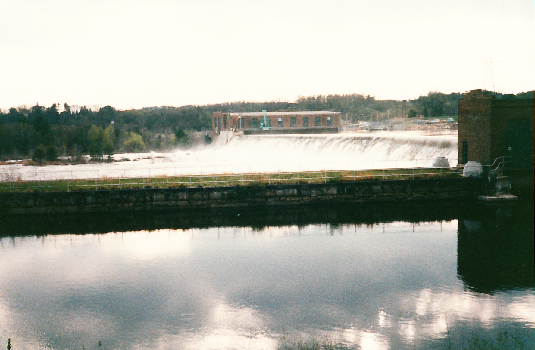
Many of these Red Barn postings have illustrated the historic seacoast region of New Hampshire where I live. While our downtown is 16 or 17 miles inland from the Atlantic, the tides roll in all the way up to the waterfalls and mill dam at the heart of our city, and then roll out, usually twice a day. In fact, Dover was an active seaport until floods and silting took their toll early in the 20th century.

Situated on the Cocheco River, as well as the Bellamy and a stretch of the Salmon Falls, Dover was once a major textiles manufacturer and railroad center. It’s part of a cluster of small cities and adjacent towns, each with its own character, that drain into the Piscataqua River before it, in turn, pours into the ocean.

In contrast, downstream on the full Piscataqua, Portsmouth boasts of an active port – one with iconic red tugboats, oceanic freighters, and active passenger cruises around the harbor, its islands, and coastal sights – stretches familiar to us from both the shoreline and ventures out on water. On the Maine side of the river, the Portsmouth Naval Shipyard builds and repairs nuclear submarines.

Upstream, however, has remained far more mysterious. Since it’s hard to glimpse much of the waterway from public roads, we’ve long wondered how the route would appear. Long ago I discovered how different a shoreline fits together when viewed from a boat rather than the lands around it. This is, after all, a major part of where we live.

The MV Heritage in Portsmouth Harbor.

At last, hearing of the Inland River Fall Foliage Cruise offered each September and October aboard the 49-passenger MV Heritage, my wife and I got a chance to see for ourselves. Depending on the timing of high tide, its daily two-and-a-half hour trip ventures from downtown Portsmouth to downtown Dover 11 or 12 miles upriver or, as an alternative, into Great Bay, itself a remarkable estuary.

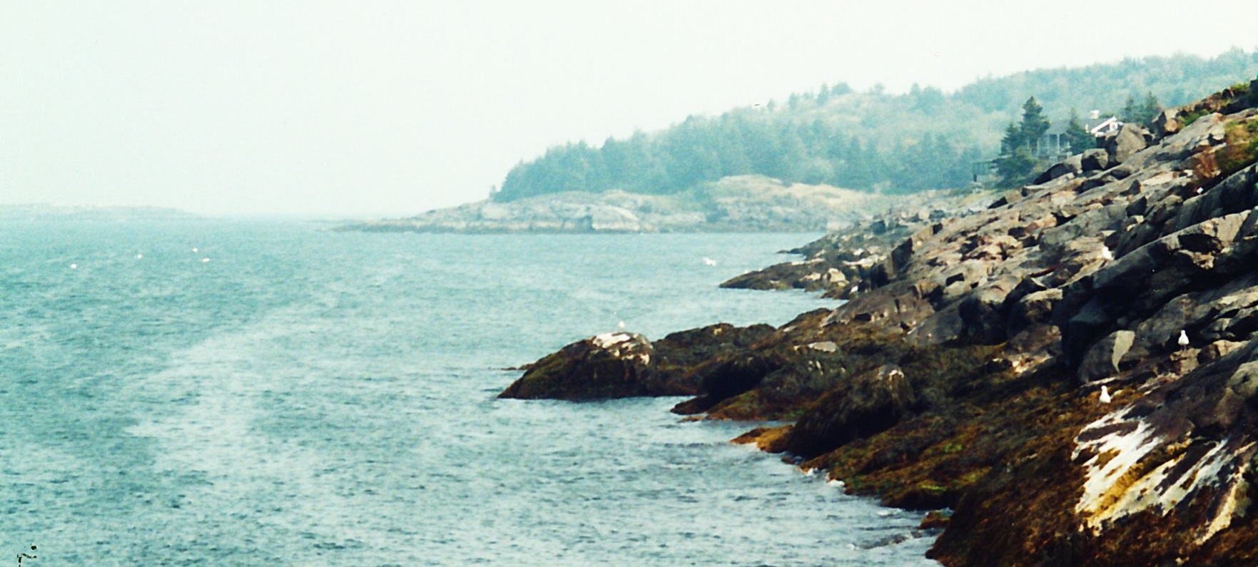
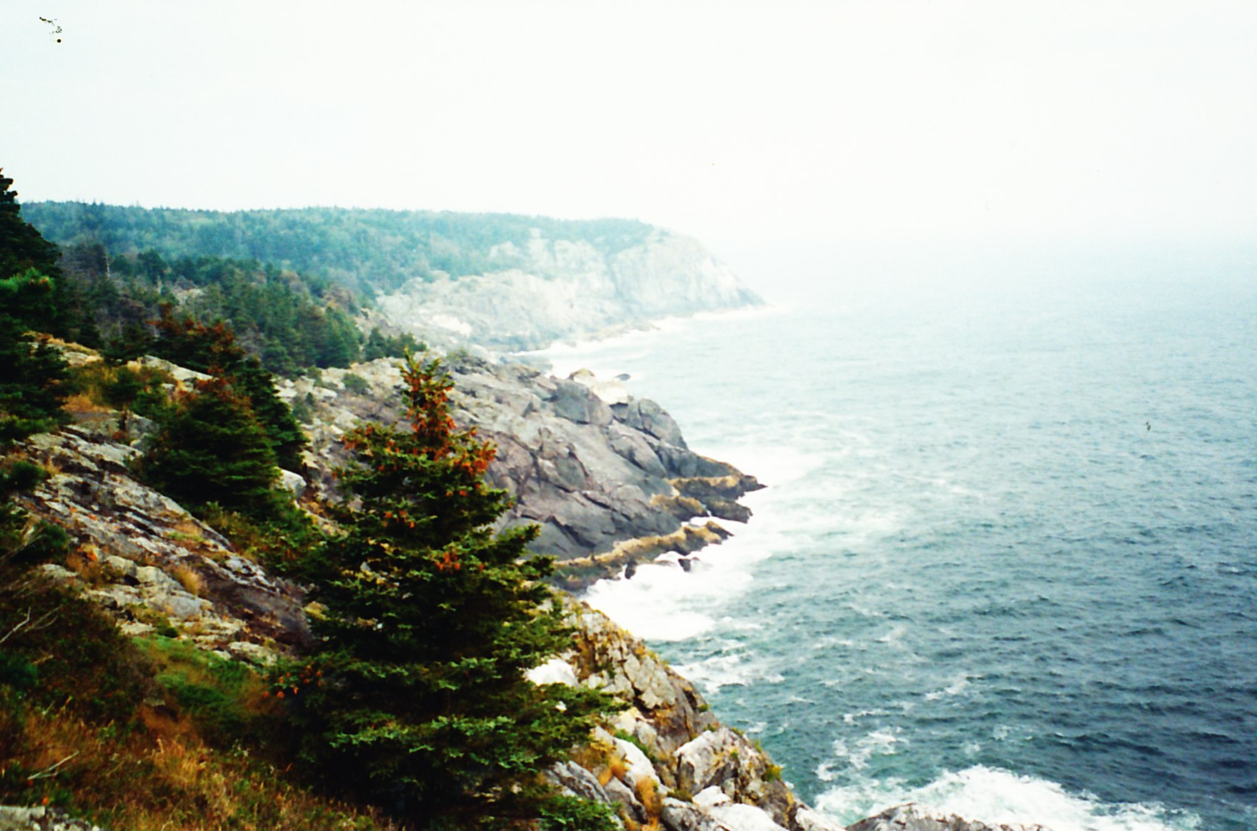
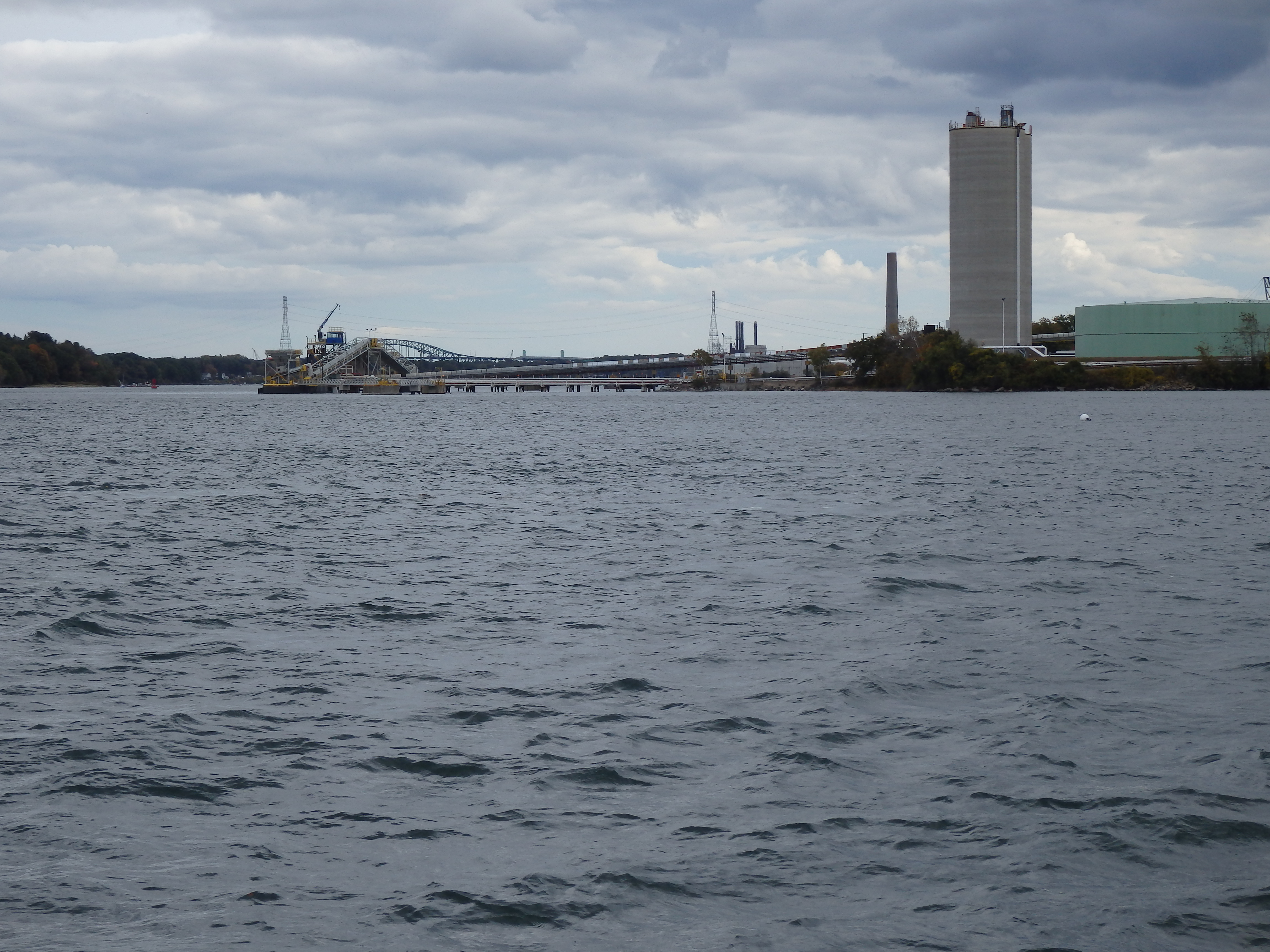
It was an eye-opener. Once we left the familiar, picturesque Colonial-era Portsmouth Harbor, we began passing all of New Hampshire’s industrial waterfront, which includes three electrical power plants, the world’s largest lobster operation, an oceanic underwater cable producer, oil tank farms, and the like – each with major docking facilities for oceanic freighters or other vessels. I hadn’t envisioned the extent of this activity. Nor had we anticipated the width of the passageway, in many places approaching three-quarters of a mile. Not what most folks would call beautiful, but it was impressive, even if we were grateful Aristotle Onassis failed in his attempt to put an oil refinery a bit upstream.

Clouds and a sharp breeze arrived quickly after we left the dock and started passing industrial waterfront.

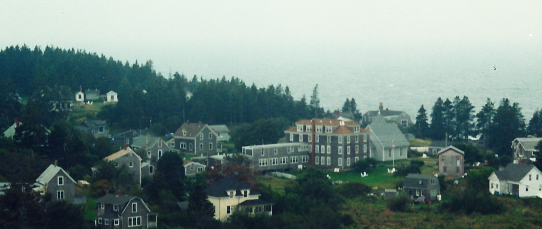
Once we’d passed the mouth to Great Bay, we were surprised by how much of Dover itself sits on the Piscataqua – and how much very expensive waterfront housing with expensive docks to match have been built there, mostly, as we were told, in the past two decades, now that the river’s been cleaned up from its earlier industrial pollution. In fact, looking at this and at the Maine side of the river gave the impression of passing high-profile lake shores with their ever more imposing year-round mansions. To be frank, we were a bit stunned by the wealth we were witnessing – where are these people in our otherwise modest city and what’s their source of income? Theirs is a different world, we’d say.

That’s not to say there weren’t stretches of colorful foliage or fascinating wildlife. In addition to a host of herons, gulls, and cormorants (we most loved the ones who stood atop mooring buoys marked “private,” as if the birds defiantly owned them), we viewed a soaring osprey and then a bald eagle in flight, an impressive hawk high in a pine overlooking the river, and a seal or two – all close to home.

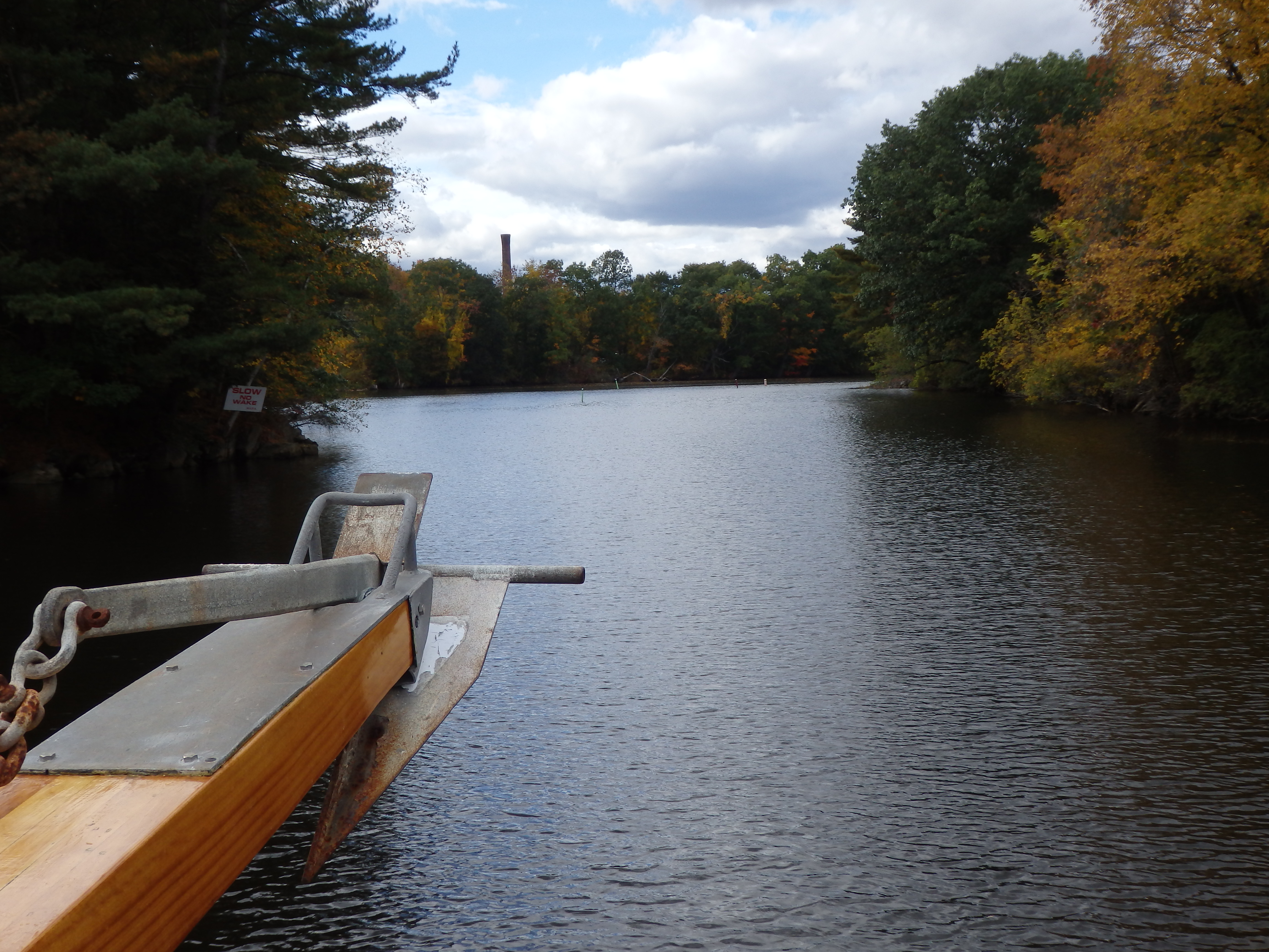
The Pisacataqua originates at the fork of the Salmon Falls and Cocheco River, which we then followed as it narrowed on its way to downtown Dover.

What a contrast!

At one broad pool, we were told that tall-mast ships turned around here before reaching the mills by being poled by hand on high tide or pulled by oxen the final few miles. And, at the upper narrows, we appreciated a friend’s work with the Army Corps of Engineers in dredging power-plant tar from the river to reopen the passage. (That could be another posting in its own right.)

We passed the marina at the edge of downtown and circled, to retrace our journey.

The final passage into downtown Dover narrows and twists. Here it is at high tide.

Why is it, the return always seems to go faster than the first part, outward?

On our drive home after debarking,  we stayed close to the rivers. Surprising how discrete the lanes to the big houses! You’d never, ever, suspect they were there if you hadn’t taken the cruise. Makes us wonder how much more is hidden just out of view.

THOSE FIRST BLUSHES OF AUTUMN COLOR

Last weekend, we got away to the Northwest corner of Vermont for a lovely, make that magical, gallivant enhanced by a Friend’s gracious hospitality.

The jaunt began with a long overdue stop at the Saint-Gaudens National Historic Site in Cornish, New Hampshire. Admittedly, sculpture – especially public statuary – has taken a lower rung on my visual awareness to painting, drawing, and printmaking. Let me say simply that this visit to the home – originally summer residence – of the American genius Augustus Saint-Gaudens was a revelation. The National Park Service has done a remarkable job in preserving not just his house and studio but in displaying his studies and castings of his memorable monuments. The glade devoted to the “Shaw Memorial” alone was worth the visit. And, let me add, the floral displays in the gardens at this time of year, when relatively little is blooming, were delightful. As for his work designing American currency, at the invitation of Teddy Roosevelt? The short take is we’re ready to return, soon.

That was followed by a late afternoon jaunt across the Cornish-Windsor covered bridge spanning the woefully low Connecticut River, due to an ongoing drought, into Vermont and eventually through the Green Mountains, taking a questionable route our host suggested through Rochester Gap and Middlebury Gap, one I doubt we would have found via GPS but altogether perfect. This was the real Vermont, not just twee but also working-class hanging in there, apparently happily so. We’re still wondering how many of these folks get to work through the winter.

Not much later we were sitting on his deck, sipping hard cider we’d brought from the Granite State and munching some amazing cheese from his locale. Oh, yes, while watching a feathery sunset stretching toward us from the New York State’s jagged Adirondack mountain range. Does life get any better than this?

The next morning brought my reason for being here, a committee meeting an hour to the north, and the first of two breath-taking mornings with a drive that included Adirondacks in the distance on one side of the highland farm country I traversed (with its seemingly contented dairy cows and huge barns), and the Green Mountains, a wall on the other side, along with glimpses of long Lake Champlain far below to the west.

Still, we weren’t seeing what we’d anticipated: signs of frost. Not all that long ago, northern New England – especially this far north – would have had a killing frost by mid-September. Instead, where we live, we’ve been able to get to the end of October with an occasional throwing blankets over the garden. In other words, global warming is real. And that frost, by tradition, is essential to the famed New England fall foliage.

Leap to Sunday morning, when we ventured off to Appalachian Gap in a second crisp, dewy morning with the mountains veiled in a haze – breathlessly, as it were. What surprised us the most was how quickly some trees were already in prime foliage, albeit surrounded by green. The color comes in waves, actually, and much of the glory depends on the ephemeral angle and quality of light more than the leaves themselves. So the autumn foliage was beginning to arrive. Just like that.

In the week since, it’s starting to appear where we live, too. And, to heighten our awareness, we know all too well what will follow, just a month hence.

~*~

My essays and photographic slide shows on New England autumn foliage are available in the archives of my Chicken Farmer I Still Love You blog. Take a peek!

WHEN NOR’EASTERS HIT HOME

New England gets hit by nasty storms called nor’easters. Often, they’re like off-season, slow-moving hurricanes that move up the coastline, spinning wind off the ocean and inward over land. That is, the wet wind comes out of the east. (Although, to be technical, it often arrives out of the south.)

Sometimes, their wallop comes as heavy rain. At other times, it’s tons of snow – even a blizzard. Either way, power outages, falling trees, wind damage to roofs and chimneys, and flooding can follow.

A power outage with flooding knocks the sump pump out, as well, and then there goes the furnace, if there are delays in restoring electrical service. To say nothing of the freezer out in the barn.

~*~

The so-called Perfect Storm, by the way, was one more nor’easter. A reminder to take these things quite seriously.

ALONG THE MERRIMACK

The Amoskeag dam sits atop a waterfall. I lived just upstream.
The Amoskeag dam sits atop a waterfall. My apartment was just upstream.
The creaky Boston & Maine tracks paralleled the river.

For three years I lived along the banks of the Merrimack River, a primary energy source for 19th century New England industry.

Wouldn't have minded living in the old North Station, now converted to private residence.
Wouldn’t have minded calling the old North Station, now converted to private residence, my home.