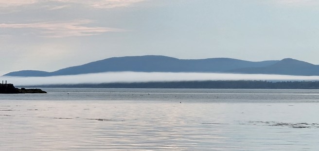
With the Camden Hills as a backdrop, a late afternoon fog rolls in over Maine’s Penobscot Bay.
For more schooner sailing experiences, take a look at my Under Sail photo album at Thistle Finch editions.
You never know what we'll churn up in cleaning a stall
With the Camden Hills as a backdrop, a late afternoon fog rolls in over Maine’s Penobscot Bay.
For more schooner sailing experiences, take a look at my Under Sail photo album at Thistle Finch editions.
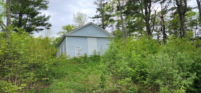
The former home of Methodist Episcopal congregation in Edmunds, Maine, once looked out over the Lower Bridge across the Dennys River. The bridge disappeared after U.S. 1 was routed a quarter-mile to the east. The church, meanwhile, is being encroached by forest, a reminder of a more populous and more prosperous time. Its square belfry is long gone.
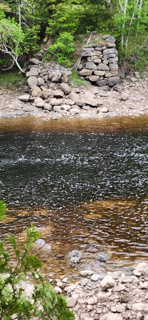
Below, remaining stone abutment of the bridge is seen on the Dennysville side of the river at low tide.
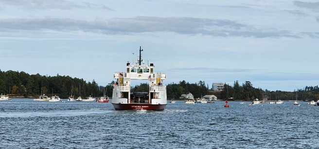 A state ferry conveys autos and passengers along the Fox Islands Thoroughfare as it links North Haven Island and the mainland on one of three daily runs. This shot was taken aboard the historic schooner Louis R. French last summer.
For more schooner sailing experiences, take a look at my Under Sail photo album at Thistle Finch editions.
Set out in your swimwear and hit the beach for a day in the water and sunning.
It’s too much on the chilly side, for starters. As for the beaches around here? They’re small, pockets of rocks and pebbles, mostly – rarely sand.
Dine out at a different restaurant every night. Not unless you want to drive a distance.
Go out dancing through the night. Midnight is 8 pm.
Just so you know what you’re in for.

Sometimes our vegetable beds look nearly perfect.

We were passed by this sailboat. It still looks breathtaking and even scary.
Seen from a cruise aboard the historic schooner Louis R. French last summer.
For more schooner sailing experiences, take a look at my Under Sail photo album at Thistle Finch editions.
Real estate transactions did use the lot at the corner of Water and Third streets as a referent for other lots. We’ve already seen examples of John senior’s mention of “land owned by me” and the like. Later, we encounter “the homestead of my late father John Shackford” and “the old homestead of my father the late John Shackford.”
Yes, homestead.

After considering the 1806 Samuel Wheeler house at 9 Washington Street and the Federal-style 1805 Hayden (the oldest two-story dwelling in town), the circa 1807 Lewis Frederick Delesdernier on Franklin Street, the 1810 Jonathan Weston, 1820 Daniel Kilby, and 1821-1822 Stetson-Starboard houses on Boynton Street as well as an 1812 Cape on Washington Street, the 1816-1818 Dr. Micajah C. Hawkes on Shackford Street, 1819 Jonathan Venzim-E.E. Shead on Middle Street, and 1821 William Bucknam and Captain Joseph Livermore houses on Key Street, I’m confident that ours predates them and may indeed be older than 1803, as the routing of Water Street route proposed.
I’m willing to venture 1780s. Feel free to argue otherwise.

As for time? An Eastport Sentinel article on the Wheeler house, March 29, 1882, mentioned that under the ownership of Bion Bradbury, the home “was changed by the substitution of a pitch roof,” among other modernizations. I hadn’t really considered the pitch of our roof until this but now realize it is lower (or was, before our own modernizations) than many of the later structures in town. The Federal-style houses, of course, are an exception.
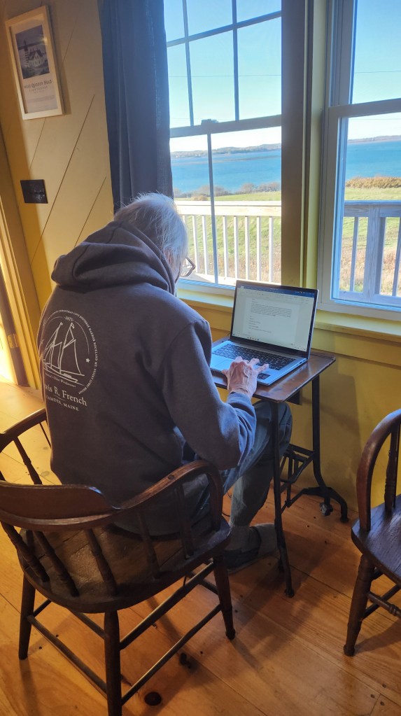 Here I am at the keyboard while overlooking Lubec Channel from a rented cabin at West Quoddy Station, a former U.S. Coast Guard lifesaving post. We needed to vacate our home for two days during its renovation, and we settled on this, still in sight of Eastport on the water to the north and yet a world away.
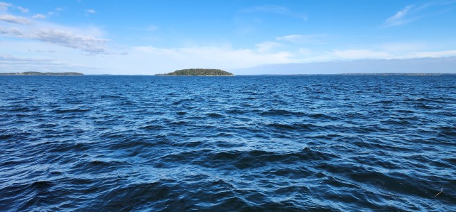 As seen from a cruise aboard the historic schooner Louis R. French on Penobscot Bay last summer.
For more schooner sailing experiences, take a look at my Under Sail photo album at Thistle Finch editions.
While the 100-acre Shackford holdings along Water Street underwent subdivision and real estate development, the 100 acres at Shackford Head remained intact. So far, I’ve been unable to locate the original title that would have been bestowed by the Commonwealth of Massachusetts to Captain John Shackford senior, but the documents for the adjacent Coney or Cony Farm repeatedly refer to the land held by John Shackford, during his life, or later, “land formerly of John Shackford.”
In 1837, when Joseph Coney leased his 40-acre farm to his son, Samuel May Coney (1812-1895), the rent was recorded as one cent a year.
Samuel soon came into full possession. By the time of his death, he had added the Shackford property, too, as was noted in the sale from the estate (attorney John H. McFaul) to Charles O. Furbush in 1896. That transaction included an 1895 Plan of Shackford Head by surveyor H.R. Taylor.
All of this would become part of the controversial attempt of Pittston Company’s attempt to build a massive oil terminal and refinery on the site in the 1970s.
I can see why Shackford heirs living in Eastport would have held onto the rugged land. A house could go through 40 cords of firewood in a year, and with seven homes or more at times, having a large wooded reserve would have been useful. Depending on the proximity of a sawmill, the wooded land could have also supplied the Shackford shipyard or even the wood in our house.
